Water Year (2020-21) in Review

A summary of the 2020-21 water year (Oct. 1 to Sept. 30) makes one think of the old expression: “Is the glass half full or half empty?”

While much of the western United States suffered from a long-term drought (see the end-of-September drought map), Nebraska – and perhaps Lake McConaughy – fared a bit better.

If you’re in the “glass half empty” camp, inflows to Lake McConaughy during the water year (WY) amounted to just over 642,000 acre-feet (af), the 14th lowest WY total since Kingsley Dam was closed in 1941.  The historic median WY inflow is 928,964 af.

Typically, the months of October and November see the highest inflow totals to Lake McConaughy, but last year’s total for those two months amounted to only 79% of normal.  Spring (March-May) inflows were only 69% of normal.  As a result, the reservoir peaked on June 5 at elevation 3,250.9 feet, about 14 feet below capacity.  It reached its low elevation for the year in early September at 3,235.4 feet, a drawdown of 15.5 feet.

It should be noted that releases from the Environmental Account (a block of water managed by the U.S. Fish and Wildlife Service to benefit wildlife habitat along the river) from mid-May through June contributed to the drawdown, as did releases for several irrigation canals along the North Platte and Platte Rivers operated by entities other than Central.

For those who subscribe to the “glass half full” attitude, despite the combined demands, releases during the water year were only 80% of the historic median and 90% of the 30-year median.  Also, much of the irrigated area served by Central benefitted from rainfall that was slightly above normal during the growing season, despite some stretches of hot, dry weather.

And the fact that the reservoir only declined by 15.5 feet given the scarcity of inflows – and little contribution from the South Platte River, water from which can be used to reduce releases from Lake McConaughy – is testament to the tremendous gains in producers’ on-farm irrigation efficiency, as well as efforts by Central to improve its conveyance system over the years.

With meteorologists predicting a second year of a La Niña weather pattern (a natural ocean-atmospheric condition marked by cooler-than-average sea surface temperatures across the central and eastern Pacific Ocean near the equator that impacts weather across the world), what does that mean for snowpack development in the Upper Platte Basin this fall and winter?

According to the National Oceanic and Atmospheric Administration’s Climate Prediction Center, the central Rocky Mountains will likely see continued dry conditions this winter with equal chances of below-, near- or above average temperatures, while Nebraska’s winter has equal chances for below-, near- or above-average precipitation and temperatures.

In other words, we’ll just have to wait and see.

Review of ‘Unusual’ 2018-19 Water Year

To say it has been an unusual year is perhaps an understatement.

The 2018-19 water year ended on Sept. 30 (a water year runs from Oct. 1 to Sept. 30 of the next year) and it was a year marked by heavy and frequent rain storms, floods, planting delays, bone-chilling winter temperatures, and even “bomb cyclones,” among other anomalies in terms of weather and water.

While this part of Nebraska was largely spared from the calamities that befell other parts of the state (except for the deluge that caused flooding along Turkey Creek in Kearney and the Wood River flooding that struck several other central Nebraska towns), it has also been an unusual year for the water supply at Lake McConaughy.  While total water year inflows were above average, the 1.19 million acre-feet barely cracked the Top 20, finishing at 19th highest in the reservoir’s history.  (An acre-foot is the volume of water that would cover one acre with 12 inches.)

But it was the inflows during the summer months that made the water year unusual.  Normally inflows are highest in October and then in May and early June.  In fact, from October of last year through May, inflows were pretty much in line with the normal monthly averages.

Then came summer.  Inflows to Lake McConaughy during June were twice the normal amount; more than two and a half times normal in July; and 348 percent of normal in August.  In fact, the 162,843 acre-feet (a-f) that flowed into Lake McConaughy in August was the highest monthly total for the year.  Historically, as one would expect in a snowmelt-fed basin, inflows during August are near the low point for the year, trailing only July (median inflows of 46,815 a-f in August and 45,718 a-f in July).

Several factors converged to yield this outcome.  First, mountain snowpack in Colorado and Wyoming was above average in all three basins – the upper and lower North Platte River and the South Platte River – that affect river flows into Nebraska.  The subsequent runoff, particularly in the North Platte Basin in which Lake McConaughy is located, entered U.S. Bureau of Reclamation (USBR) reservoirs in Wyoming that were already holding plentiful supplies of carryover storage from the last year.

Second, frequent precipitation across much of the Platte Valley suppressed demand for irrigation.  Rainfall during the growing season (April through September) collected in Central’s Holdrege gauge totaled 25.44 inches, compared with the 20-year average of 18.63 inches and 19.0 inches since 1957.

However, the frequency of precipitation perhaps played a more significant part in reducing irrigation demand than the amount of rainfall.  Few weeks went by this summer without some amount of rain, which was often enough to dissuade an irrigator from starting his pivot or opening the gates on his pipe.

And finally, a mid-July tunnel collapse on an irrigation canal that delivers water to the Goshen Irrigation District in Wyoming and the Gering-Ft. Laramie Canal in Nebraska’s Panhandle, prevented delivery of water to about 107,000 acres in the two states.  With abundant water already in storage and the approaching need to make room for next year’s inflows, releases from the USBR reservoirs that normally would been diverted into the two canals continued downstream to Lake McConaughy.

Lake McConaughy’s lowest elevation (3,252.5 feet above sea level) during the 2018-19 water year actually occurred on Oct. 1, 2018, the first day of the water year.  The reservoir’s peak elevation occurred on July 15 at 3,260.1 feet, declining to elevation 3,257.9 in mid-August and currently stands near elevation 3,259.0, about six feet below full elevation.

And here’s an interesting observation:  Lake McConaughy’s elevation of 3,258.7 feet on Aug. 31 was the same as it was on Aug. 1.  A check back through the data reveals that that has never happened in the reservoir’s 79 years.  While August’s inflows were well short of a record amount, the monthly total did rank fifth behind 2010, 1973, 2011 and the record of more than 328,000 a-f in 1983.

So if you’ve noticed quite a bit more water flowing down the Platte River this summer, that’s the explanation.  A lot of water going into Lake McConaughy, and once it was released, not much demand for it to be diverted into the many irrigation canals along the central Platte.

With long-range forecasts calling for a cold and wet winter, one wonders what Mother Nature has in store for Nebraska in the new water year.

###

Spring has sprung (hasn’t it?), and water’s flowing downhill

Spring has sprung (hasn’t it?), and water’s flowing downhill

During Central’s April board meeting, Hydraulic Project Operations Manager Cory Steinke engaged board members and everyone else at the meeting in an exercise to illustrate the complexity and difficulty of managing water supplies.

Each participant was given a stack of pennies that represented the existing – and future – water supply in storage at Lake McConaughy.

The point of the exercise was to complete a four-year cycle of inflows and releases without 1) running out of pennies (water); and 2) leaving insufficient space for additional pennies (inflows) resulting in a “spill” of valuable water.  (A “spill” is a release of excess water from a reservoir.)

During the exercise, Steinke was repeatedly asked for more information pertaining to various snowpack conditions, irrigation demand, upstream storage reservoir conditions, weather forecasts, etc.  But a crystal ball was not part of the game, just as water managers usually cannot see clearly very far into the future.  They must rely on the best available information – both short-term and long-term – on which to base their decisions and even the best, most recent information, can be subject to rapid change.

Operational projections begin with known quantities of water in storage at the beginning and end of any particular cycle.  Despite having access to the latest forecasts, any unexpected changes to any of the numerous factors that influence water management operations could leave the participants “penniless,” or at the other end of the spectrum, having too many pennies in the bank.

One need look no further than the recent events afflicting eastern and northeastern Nebraska and western Iowa.  The flood damages were the result of a series of unlikely events occurring simultaneously, creating a scenario that overwhelmed manmade dikes, dams and operational plans and caused creeks and rivers to swell out of their banks.

A coincidence of “unlikely events” is not the same as “impossible events;” even planning that prepared for “unlikely events” and “maximum probable floods” was overcome by the capriciousness of weather and Nature’s unrelenting power.

While flooding along the Platte River did not occur in central and western Nebraska, spring is the time of year when water managers keep particularly close watch on conditions in the upper Platte River basin.

The U.S. Bureau of Reclamation, which manages a series of reservoirs on the North Platte River in Wyoming and monitors snowpack/snowmelt conditions in the North Platte and South Platte drainage basins, recently released its projections for runoff.

The April forecasts indicate the spring snowmelt runoff will be above average.  Total April through July runoff in the North Platte River Basin above Glendo Dam in Wyoming is expected to be 1,005,000 acre-feet (a-f) which is 111% of the 30-year average.

As of March 31, storage content in the North Platte Reservoirs was 1.8 million a-f, which is 110% of the 30-year average.  The total conservation storage capacity of the North Platte Reservoir System is approximately 2.8 million a-f.  At this time, the Bureau is not anticipating a spill of water from Pathfinder Reservoir.

In the South Platte River basin, snowpack conditions are currently at, or slightly above, normal for early April.

Prior to the projections, Central had noticed the increasing snowpack and began making adjustments to water operations to leave space in Lake McConaughy for any extra water released from the upstream reservoirs.

However, the South Platte River remains, as always, a wildcard.  With only minimal amount of off-stream storage capability in Colorado, the South Platte remains susceptible to rapid snowmelt runoff and heavy spring rains that could cause high-water events in western and central Nebraska after it joins with the North Platte River east of the City of North Platte.

Central will continue to monitor developments in the North and South Platte River basins this spring and is tailoring operations to developing conditions, including precipitation forecasts for April and May that call for increased chances for above normal precipitation throughout most of the Platte River Basin.  Lake McConaughy has no designated flood pool (an amount of space in a reservoir designed for flood control used to regulate floodwaters), other than gradually rising restrictions on maximum elevation during the spring, but the reservoir has been operated during high-flow periods when necessary to mitigate downstream flooding that is often the result of high South Platte River flows.

But as demonstrated by recent events, Mother Nature sometimes has plans of her own that overwhelm human efforts to manage our rivers and streams.

(###)

Central Hosts Leadership Nebraska Class XI

Central Hosts Leadership Nebraska Class XI

The Central Nebraska Public Power and Irrigation District had the great pleasure to host Class XI of the Leadership Nebraska program at Kingsley Dam/Lake McConaughy on Aug. 16, 2018.

Numbering around 25 people, the class learned about the construction, development and operation of the Central District while visiting the Nebraska Game and Parks Commission’s Visitors Center/Water Interpretive Center, as well as Lake McConaughy’s outlet structures and the Kingsley Hydroplant.

During the briefing about the District’s operations, the group learned that the annual economic impact of the Kingsley Dam/Lake McConaughy hydroelectric-irrigation project is estimated to be between $556 to $806 million (according to a study conducted by the U.S. Bureau of Reclamation as part of the development of the Platte River Recovery Implementation Program in the early 2000s).

The economic benefits were diverse and derived from irrigation for agriculture, recreational pursuits at Lake McConaughy and associated facilities, hydropower generation and power plant cooling water.

Devin Brundage (top center in red shirt) explains the operation of the Kingsley Hydroplant to Leadership class members.

The class also listened to a presentation by Colby Johnson, NGPC’s regional park superintendent, about the economic and social impact at recreation at Lake McConaughy/Lake Ogallala as well as throughout Nebraska.

The product of planning committee formed by the Nebraska State Chamber of Commerce and Industry in 2005, the first class was assembled in 2007.  The program is geared toward people who have demonstrated community and professional leadership experiences and who desire to further develop their leadership skills and potential.

According to the Leadership Nebraska web site:

“Leadership Nebraska is a program designed for current and future Nebraska leaders to view the economic and political challenges and opportunities that face Nebraska.  (The program’s) mission is to identify, educate, communicate with, inspire and engage Nebraska’s current and emerging leaders for the well-being of the state of Nebraska.”

With the spray emitting from the bypass valve at Kingsley Hydroplant as a backdrop, Class XI poses for a group photo.

Class sessions are held in various parts of the state.  Each of the two-day sessions focuses on important issues in those areas and typically cover topics related to economic development, workforce development and education, agriculture and the environment, government and politics, and health and human services.

Central provided lunch to the class as part of the day’s activities.

(Note: Central employs three graduates of the Leadership Nebraska program:  Engineering Services Manager Eric Hixson, Class I, 2007; Public Relations Manager Jeff Buettner, Class XI, 2012; and Gothenburg Division Manager Devin Brundage, Class IX, 2016.)

#

Swimmer conquered Lake McConaughy in 1968. Why?

Swimmer conquered Lake McConaughy in 1968.  Why?

I came across an article in a recent issue of the Keith County News about a young man who swam the length of Lake McConaughy in 1968.

I’d never heard of such an accomplishment, but the article (by KCN staff writer Kenneth Lipp) indicated that it was the first time anyone had ever accomplished such a feat.  No wonder.  The swimmer, Scott Skultety of Omaha, had to travel 21 miles from the west end of the reservoir to Kingsley Dam.  It took the 17-year-old 11-½ hours to cover that distance.

Now, for someone who admittedly swims like a rock, I was duly impressed by such an accomplishment.  My first musings were:  1) Has anyone completed such a swim since 1968?  And, 2) Why would someone attempt such a challenge?

As to the first question, an internet search of long-distance swims at Lake McConaughy turned up nothing other than a reference to a planned swim by a marathon swimmer in 2017, but I could find nothing to confirm that such a swim ever took place.

The answer to the second question involves some speculation on my part, but I think it probably comes down to the reason for many other such feats.  “Because it’s there.”

In March 1923, a British mountain climber by the name of George Mallory was trying to raise money for an expedition to climb to the summit of Mount Everest.  At the time, no one had ever conquered the highest mountain on earth.  Mallory had failed on to previous attempts to reach the summit twice, but was undeterred.

When asked by a New York Times reporter why he wanted to climb Everest, his response was simply, “Because it’s there.”

From that seemingly frivolous remark, Mallory expanded in a manner that perhaps best explains the reasons for “why?”  And perhaps it explains why a lot of other such attempts are made to reach seemingly impossible goals.

“Everest is the highest mountain in the world and no man has reached its summit,” he said.  “Its existence is a challenge.  The answer is instinctive, a part, I suppose, of man’s desire to conquer the universe.”

Mallory and his climbing partner sought to quench that desire in 1924, but it cost the pair their lives.  Witnesses saw them make it to within a thousand feet of the summit, but then lost sight of them.  They were never seen again.

Successfully reaching the summit of Mount Everest had to wait until 1953 when Edmund Hillary and his Sherpa companion Tenzing Norgay reached the top.

I don’t know if young Mr. Skultety was inspired by such notions; the article didn’t address the “why” question.  But again, it was quite a feat.  Lake McConaughy is known for becoming suddenly unfriendly to boaters and swimmers alike if a sudden storm should blow up.  When the wind blows, the waves can become an issue.  Perhaps the weather forecast and the water conditions were perfect for such an adventure and he certainly didn’t have to contend with sharks, jellyfish or other such dangers (other than perhaps a careless boater running over him in mid-swim).

None of that diminishes his accomplishment.  Come on, it was more than 21 MILES!  Now, I’m aware that lots of other people compete in events that require long-distance swimming (as well as running and biking), but like I said, I’m not aware of anyone else swimming the length of the lake.  (If someone sees this post, and knows of such an accomplishment, I’d love to hear the details.)

Skultety went on to swim competitively for Kansas University and, in fact, was the 1971 Big Eight Conference swimmer of the year, but he noted in the KCN article that none of his other accomplishments has been so enduring.

Even if someone else has swam the length of Lake McConaughy since that August day in 1968, he’ll always be the first to accomplish such an exploit.

#

2016-17 Water Year in Review

2016-17 Water Year in Review

In what has become somewhat of a tradition on this blog, I’ll recap the just-concluded 2016-17 water year (a water year runs from Oct. 1 to Sept. 30 of the following year) and touch on some of the factors that influenced storage supplies at Lake McConaughy for hydroelectric generation, irrigation deliveries, groundwater recharge, wildlife habitat and recreation within Central’s project area.

Lake McConaughy, September 21, 2017 at elevation 3248.2 feet (1.27 million acre-feet).

Monthly inflows during the 2016-17 water year were very near the historical median in each of the first six months of the water year.  The reservoir got a boost during April when inflows were 152% of the historical median.  The 109,809 acre-feet (a-f) of water that flowed into Big Mac during April represents the 13th highest inflows for that month in the reservoir’s 76 years of existence.  (It should be noted that some of those April inflows included transfers from the Environmental Account in Wyoming’s Pathfinder Reservoir, which were passed through Kingsley Dam for the benefit of endangered species habitat in the central reach of the Platte River.)

Other months notable for higher than normal inflows and where they rank for that particular month:  May (140,948 acre-feet, 13th); June (150,326 acre-feet, 20th); and August (89,462 acre-feet, 10th).

Projections for inflows during May, June and into early summer were optimistic, given that the U.S. Bureau of Reclamation originally intended to release water that was in excess of its North Platte River reservoirs’ capacity to store (called a “spill”).  Although the spill didn’t materialize, inflows during May and June still were about double the historical median.  In anticipation of the projected spill, Central had increased releases from Lake McConaughy to create sufficient capacity in the reservoir to store the water, rather than pass inflows.  Passing inflows through a full reservoir could have contributed to high-water conditions downstream in the Platte Valley.  Despite the high early releases, McConaughy was still expected to reach its peak at or near the maximum elevation of 3,265.0 feet above mean sea level.

Then it didn’t.

Blame it on the amount of snowpack in the mountains of Colorado and Wyoming.  Accumulation started on a high note, particularly in the upper North Platte Basin where it was about 130% of average as late as February.  But experienced water managers will tell you that early snowpack accumulation is not near as important as what happens during the early to mid-spring period.  That tends to be the time when more snow with higher water content falls, which usually determines whether runoff will be high, low or somewhere in between.

In this case, snowfall in the upper North Platte Basin kind of petered out and total snowpack ended up below average.  In the lower basin (above Glendo Reservoir), snowpack never did reach average levels, finishing at about 90% of average, and melted rather quickly.

In the end, the projections were a little off the mark (Mother Nature is notoriously hard to predict with absolute certainty) and as a result Lake McConaughy peaked at elevation 3,258.1 feet on June 21, within a couple of days of when the “normal” peak elevation occurs.  In hindsight, which is, as they saying goes, “always 20/20,” the reservoir would most likely have reached its peak elevation if spring releases were more conservative, but Central was acting on the best available information that called for robust runoff from a snowpack … which didn’t reach expectations.

Nonetheless, total water year inflows amounted to 1,127,049 acre-feet (unofficially), which ranked 22nd in Lake McConaughy’s 76-year history.  For comparison, the historical median inflow is 915,275 acre-feet, while the median inflow over the past 30 years is 758,071 acre-feet.  It was the third consecutive year in which inflows exceeded 1 million acre-feet, but only the fifth time in the last 18 years that it exceeded the historical median.

Another indicator of good inflows occurred this year when non-irrigation season inflows surpassed the historical median of 572,223 a-f.  Non-irrigation season – or the “storage period” when there is no demand for irrigation water – is the period between and including Oct. 1 through April 30.  This year’s inflows of 588,344 a-f eclipsed the historical median, but it’s one of only four years since 1987 that this has happened.

As it turned out, lake levels and cooperative weather were just about perfect for visitors to Lake McConaughy.  The combination of plenty of water and plenty of beach is hard to beat.  Following on the heels of a year in which Lake McConaughy ranked #2 in the state – behind only Omaha’s Henry Doorly Zoo – with more than 1.3 million visitors, the Lake McConaughy State Recreation Area is expected to again top the 1 million visitor-days mark, although final numbers aren’t yet available.  One of the highlights from last summer was the record-setting number of visitors over the extended Fourth of July holiday weekend.  The Nebraska Game and Parks Commission reported that the 209,813 visitor-days recorded that weekend surpassed the old record of 181,147 set in 2014.

Turning to the irrigation season, the Irrigation Division reported that 162,363 acre-feet of water were diverted into the system during the irrigation season, with average use of 7.2 inches per acre by irrigation customers on Central’s three main irrigation canals, Phelps, E-65 and E-67.

Using delivery data from 1990, 2002 and 2012 – years similar to 2017 in terms of acres, temperatures and rainfall – we see that diversions for irrigation deliveries continue to trend downward over the past 30 years.

The 1990 diversions totaled about 249,000 acre-feet; in 2002 they were around 224,000 acre-feet; and in 2012 – a year particularly noted for lack of summer rainfall – diversions were less than 194,000 acre-feet.

Dave Ford, the Irrigation Division’s manager, attributed the declining irrigation diversions to water conservation efforts and efficiency measures by Central’s customers and within the conveyance system.

“The bottom line,” he said, “is that our customers are growing more crops with less water.”

Over the past 30 years, average diversions into the irrigation canals have dropped from about 225,000 acre-feet/year to around 150,000 acre-feet/year, although that number includes six years during which irrigation customers were allocated less than their full supply of water as a result of an extended drought during the mid-2000s.

I’ll also mention that the 7.2 inches/acre average use was about two inches less than the average over the past 20 years, another indication of efficiency gains and (timely) rainfall.  Finally, of the 162,363 acre-feet diverted into the irrigation canals, more than 101,000 acre-feet was documented as going to groundwater recharge in the area during the irrigation season.  (Note that Central is also planning off-season recharge efforts with its canals as long as the weather and flows in the river cooperate.)

So all in all, it was a pretty good water year.  With all-too-fresh memories of years when inflows failed to surpass 500,000 acre-feet, we are thankful any time they surpass the 1 million mark.

As for the new (2017-18) water year, we’ll have to wait awhile and see.  For what it’s worth, the Old Farmer’s Almanac (hey, they’re as accurate as just about anyone else!) forecast for the inter-mountain region — the area where snowmelt feeds the Platte Basin — says, “Winter will be colder than normal, especially in the south, with the coldest periods from late November into early December and in late December, mid-January, and early February.  Precipitation will be slightly below normal in the north and above in the south, with above-normal snowfall in both.  The snowiest periods will be in early and mid- to late December, mid-January, early and mid-February, and early March.  April and May will be warmer and slightly drier than normal.

Finally, upstream storage in the Bureau’s North Platte Reservoirs is in good shape with Pathfinder Reservoir currently at 74% of capacity and Seminoe Reservoir 80% full.  That’s a good way to start a new year!

The blog author does not claim to be a hydrologist, but some people think he’s all wet.

2017 Water & Natural Resources Tour: Education and Fun

2017 Water & Natural Resources Tour:  Education and Fun

The focus of the recent Water & Natural Resources Tour was on educating and informing participants about the many uses and benefits of water within the Platte River Basin between Ogallala and Holdrege, but there was plenty of fun, food and, yes, even exercise during the three-day tour.

What follows is a short(?) recap of the tour, along with some observations from the tour.

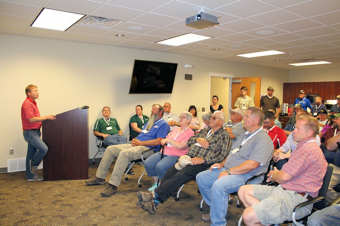
The tour participants – numbering more than 50 – assembled at Central’s administrative headquarters on the morning of June 27 and headed out via motor coach for the first stop at a site just south of the Platte River near between Elm Creek and Overton.  The site is part of what is called the Cottonwood Ranch complex, which is owned by the Nebraska Public Power District and managed for wildlife habitat purposes by the Platte River Recovery Implementation Program (Program).

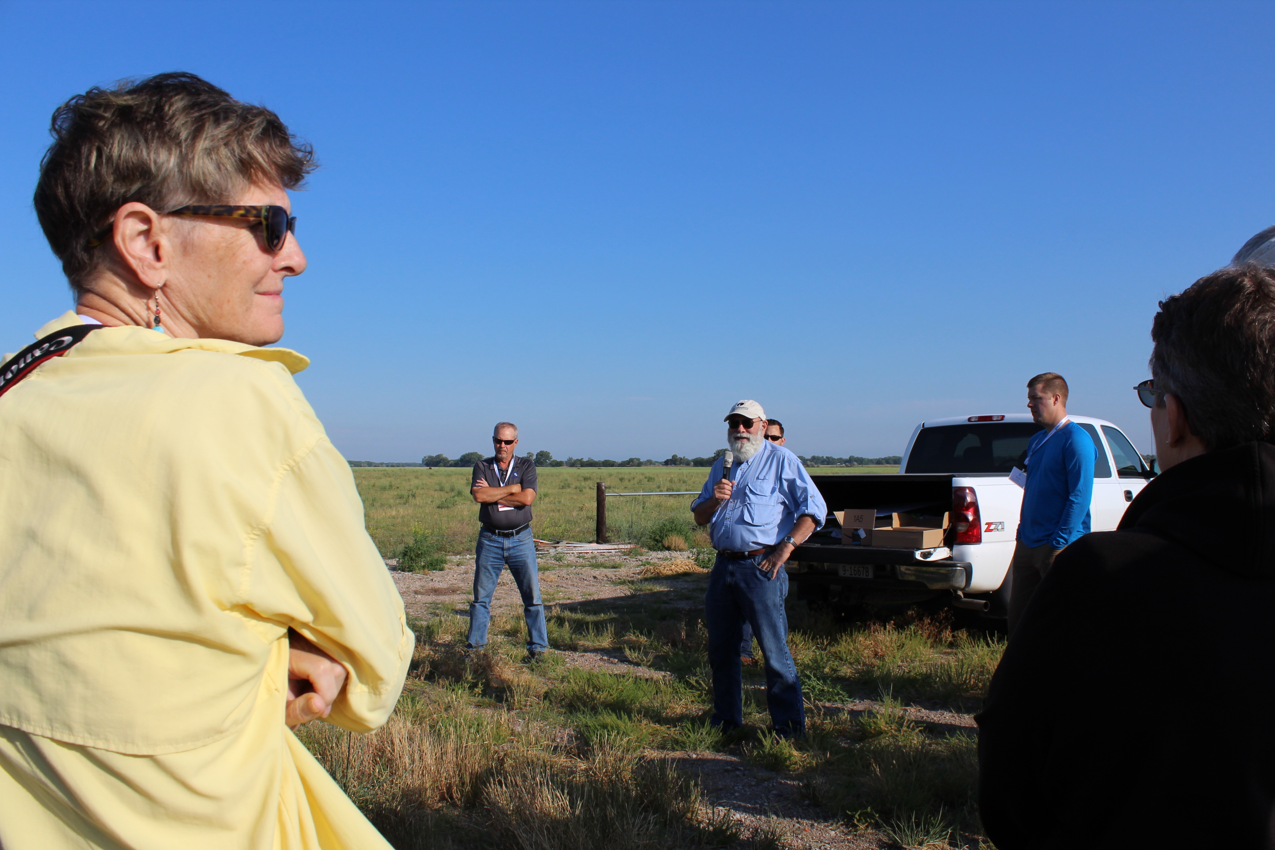
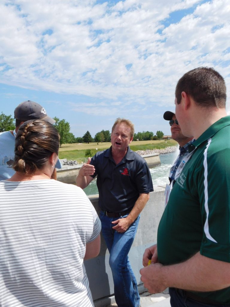
Jerry Kenny (with microphone) of the Platte River Recovery Implementation Program describes plans for a groundwater recharge/river flow enhancement project during the 2017 tour.

Part of the 3,000-acre ranch is comprised of grasslands and wet meadows and it is here that the Program is investigating prospects for a groundwater recharge project that will benefit base flows in the Platte River.  The idea is to construct earthen berms around about 300 acres in the area, fill them with anywhere from six to 14 inches of water and allow the water to seep into the ground, which will eventually return to the river.  The shallow water would also presumably attract migrating whooping cranes as a place to forage and roost.

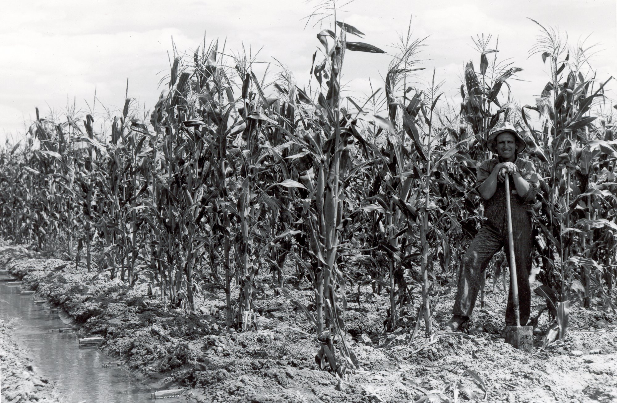
From there the tour headed to the Tom Schwarz farm to check out one of the few organic farming operations in the area.  It is here that Tom, his family and a few hired hands raise organic crops and vegetables in adjacent fields and small greenhouses.  The greenhouses recently sustained heavy damage from a spring storm, but inside one of the relatively undamaged structures, Tom showed off rows of peppers, tomatoes and other vegetables that are being raised without pesticides, herbicides or non-organic fertilizer.  Tom also has plans to begin a small organically raised cattle herd.

On the bus on the way to the next stop, John Thorburn, manager of the Tri-Basin Natural Resources District, explained the proposed Platte to Republican Diversion Project.  The PRD Project, as it has become known, would deliver water from the E-65 Canal to the mouth of Turkey Creek through a pipeline bored beneath Highway 23 and the railroad tracks during times when there are excess flows in the Platte River.  Any water appropriations granted by the Nebraska Department of Natural Resources would be junior to all current or future appropriations in the Platte River watershed.  The project is intended to help reach objectives related to the NRDs’ Integrated Water Resources Management Plans and to assist in compliance with the Republican River Compact between Nebraska and Kansas.

After about 45 minutes at the Schwarz farm, the tour headed for Elwood Reservoir and the Carl T. Curtis Pump Station, which were added to Central’s system in 1977 to improve delivery surface throughout the E-65 Canal’s service area.  The reservoir is also used for groundwater recharge purposes during the non-irrigation season and has become known as an excellent walleye fishery.  Water is pumped into the reservoir at the pump station and then allowed to run back out by gravity when needed for irrigation deliveries.

The bus then traveled across the Johnson Lake dam; on the way the riders observed the synthetic membrane lining (a water conservation/canal efficiency measure) in the upper end of the E-65 Canal, the headgate of the canal and the inlet structure on the lake’s west side.

After a busy morning, lunch was served at the Monsanto Water Utilization Center near Gothenburg while Duane Woodward from the Central Platte Natural Resources District talked to the group about groundwater recharge efforts within the district.

After lunch the group headed out to the fields on pickup truck-pulled trolleys to examine studies of yields, insect and weed control, plant health and fertility, microbials, canopy height, drought stress and other topics.  The tour participants also observed how the center’s “rain-out shelter” is used to ensure precipitation doesn’t interfere with studies involving drought resistance of crops.

(Author’s note:  Keep in mind, all of these tour visits occurred on the same day, and we’re not finished yet!)

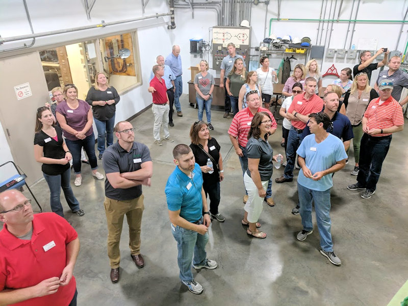
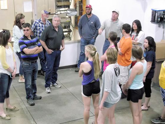
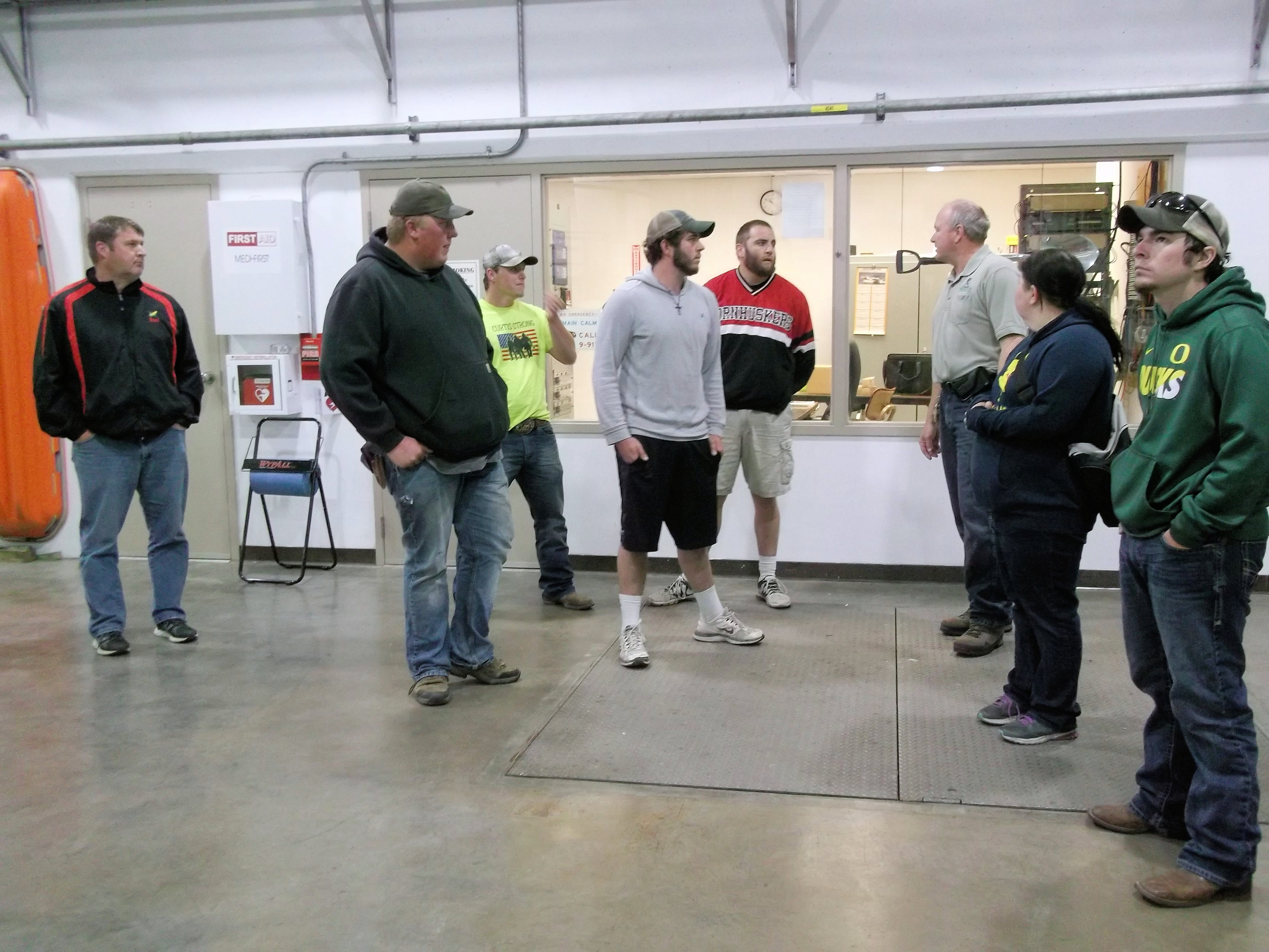
After a quick pause for refreshments, the group headed into Gothenburg for a tour of the Frito Lay Corn Handling Facility, where they learned that any of the snack chips consumed west of the Mississippi River originated as corn passing through this facility.  Plant managers showed and explained to the group the control room, the load-out bays and the storage facilities at the plant.

The bus then headed down the street to Central’s Gothenburg Control Center from which operational monitoring and control of most of the District’s canal structures, pump stations and hydroplants is performed.  Gothenburg Division Manager Devin Brundage also explained how the water passing through Central’s system originates as snow and rain in the Rocky Mountains of Colorado and Wyoming before passing through a series of U.S. Bureau of Reclamation reservoirs and several upstream irrigation projects before entering Lake McConaughy.

Central’s Gothenburg Division Manager Devin Brundage explains how the District’s control center operates the hydroelectric/irrigation project.

After checking into their North Platte motel, the group was treated to dinner and wine at the Feather River Winery and Vineyard, after which the vineyard’s owner explained how the facility came to be and the process of growing hybrid grapes for wine production in Nebraska’s often harsh climate extremes.

Day 2

After a good night’s rest (well-deserved given the pace of the first day!), the tour participants boarded the bus for a stop along NPPD’s Sutherland Canal at which a still-under-construction pipeline will eventually deliver water from the Nebraska Cooperative Republican Platte Enhancement Project (NCORPE) well field.  A 19,500-acre farm was purchased in 2012 by a consortium of four NRDs (Upper Republican, Middle Republican, Lower Republican and Twin Platte), the cropland was converted to grassland and the irrigation wells – instead of feeding pivots – were hooked to a pipeline to deliver water to the Republican River Basin to help Nebraska’s compliance with the Kansas-Nebraska Republican River Compact.  The pipeline currently under construction will move water north to the canal and then back to the South Platte River as part of the Twin Platte NRD’s efforts to offset depletions to the Platte River caused by groundwater pumping.  TPNRD Manager Kent Miller and NCORPE manager Kyle Shepherd (who also participated in the entire tour) were on hand to explain the project’s details.

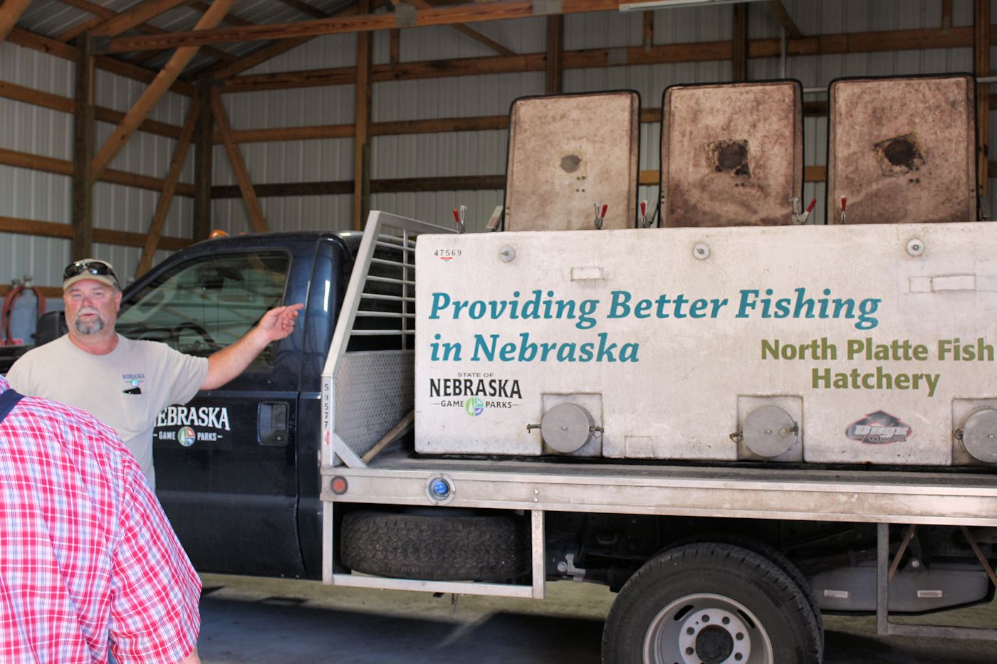
The next stop was nearby:  the Nebraska Game and Parks Commission’s North Platte Fish Hatchery.  Hatchery personnel, including manager Dirk Higgins, showed everyone around, including how the facility produces a variety of cool-water and warm-water fish species including walleye, white bass, blue catfish and channel catfish.  When needed, the hatchery also produces yellow perch, black and white crappie, blue catfish, wiper, striped bass, bluegill, muskellunge, tiger muskie, smallmouth bass, grass carp, northern pike and largemouth bass.  North Platte hatchery staff also makes annual collections of walleye and white bass eggs and milt from regional water bodies.  A relatively new activity at the hatchery is an effort to raise freshwater mussels, which are becoming less abundant in Nebraska’s lakes, rivers and streams.

The manager of the NGPC fish hatchery at North Platte describes the process of stocking many species of fish into Nebraska’s lakes and streams.

The bus didn’t have to travel far to reach the next stop, the UNL West Central Research and Extension Center, just a mile down the road from the hatchery.  At the center also known as the “State Farm,” Doug Hallum, Chuck Burr and Daran Rudnick explained current research activities on best management practices and measures to help producers get the most benefit from their water supplies.  Entomologist Julie Peterson also explained how the center is investigating the use of biological controls (read: bugs and/or viruses that target insect pests on the farm) as possible tools to supplement or replace chemical pesticides.

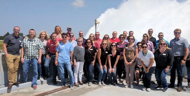
Lunch was served at the “Farm” and the group departed for its next stop at NPPD’s Gerald Gentleman Station (GGS) near Sutherland.  GGS is Nebraska’s largest power plant in terms of generating capacity.  Station Manager Gerry Phelps and a team of tour guides from the station explained the plant’s operation from top to bottom and how water from Lake McConaughy is used to cool the condensers (returning the steam that passes through the turbines to a liquid state).

The tour also included a trip to the plant’s roof, where participants could see the coal yard and immense coal-handling equipment, the water works (including Sutherland Reservoir) and enjoy the view up and down the Platte River Valley.

After the 2-1/2 hour tour concluded, the bus headed for its Ogallala motel to prepare for dinner at the Haythorn Ranch north of Kingsley Dam.  The participants were treated to a wonderful meal by Jody Haythorn and her staff at the Figure 4 Traditions banquet facility and also witnessed a spectacular sunset over the Sandhills.  As the group lingered on the veranda in the fading light, turkeys strutted across a nearby pasture where a few horses seemed to completely ignore them.  Begrudgingly, the group had to be prodded to board the bus and leave the idyllic setting as storm clouds – which would later bring torrential rain – began to roll in.

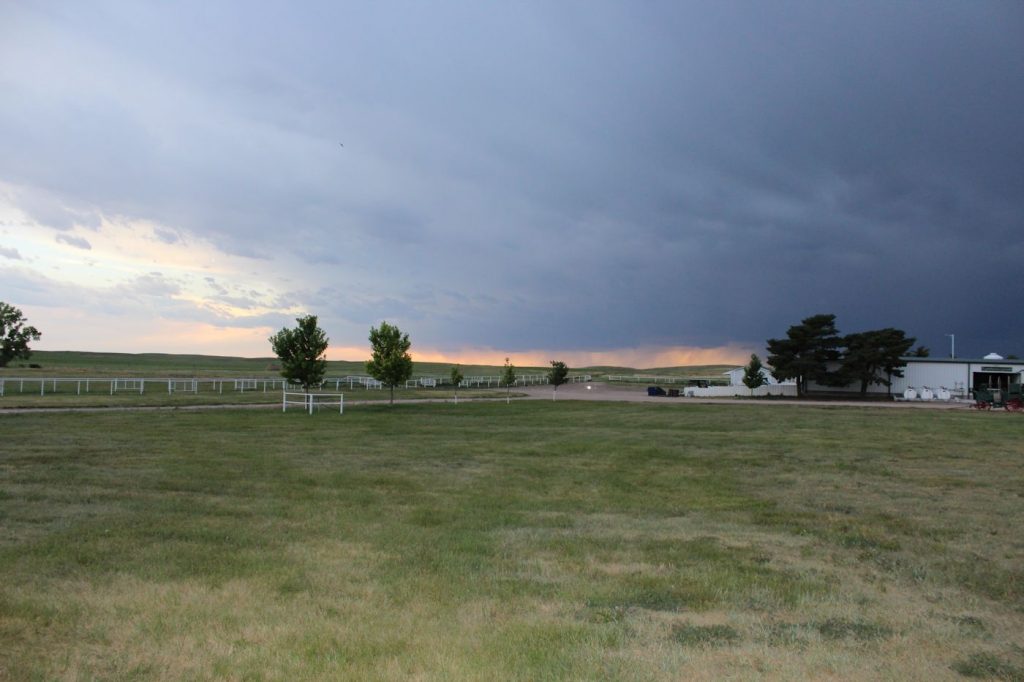
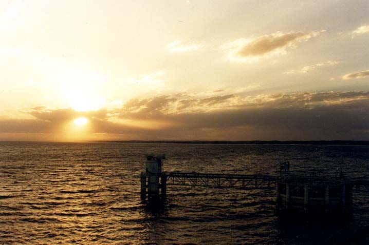
A gorgeous sunset — and an approaching thunderstorm — at the Haythorn Ranch north of Lake McConaughy where the tour group enjoyed a terrific meal and a wonderful atmosphere.

Day 3

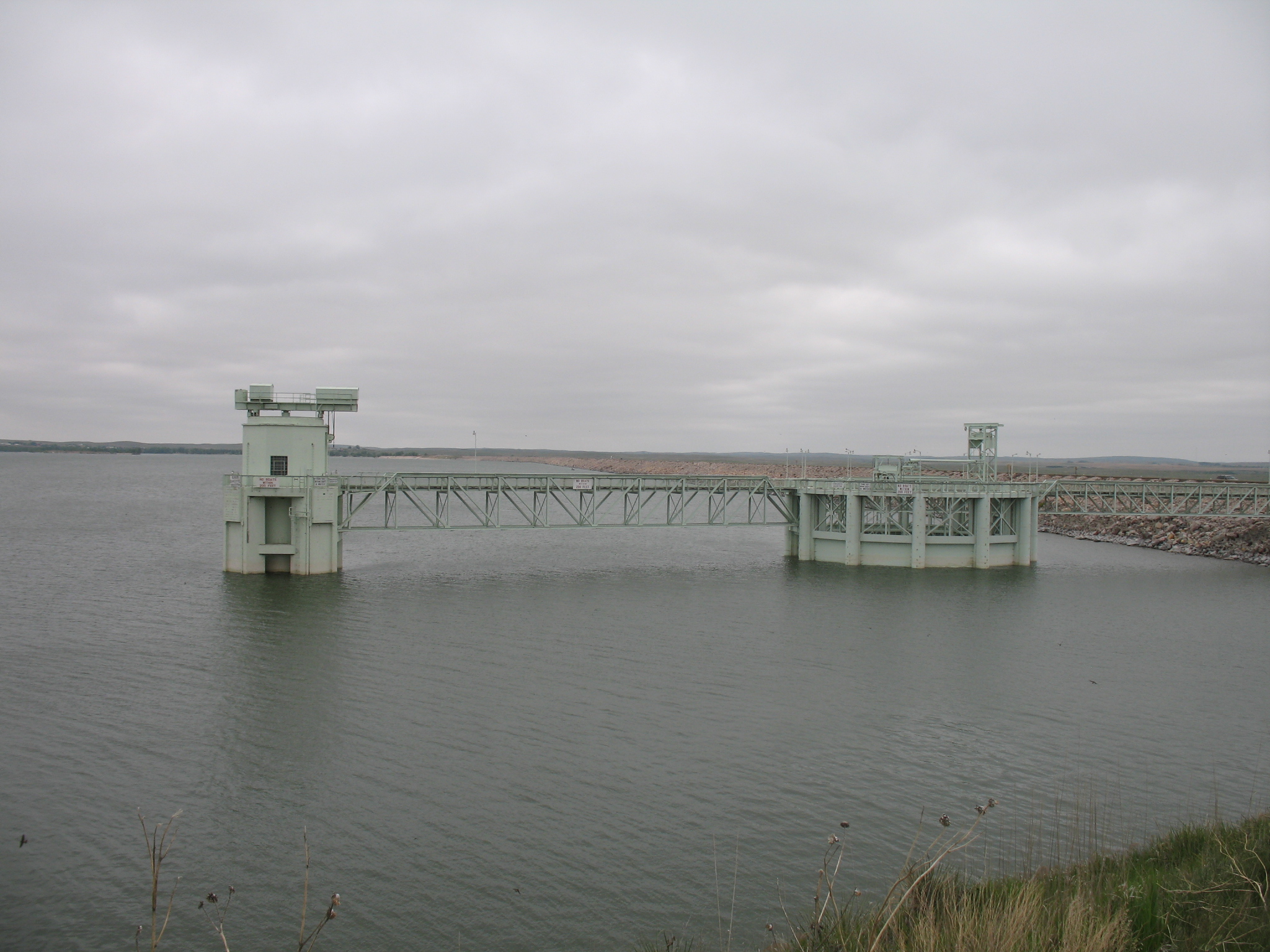
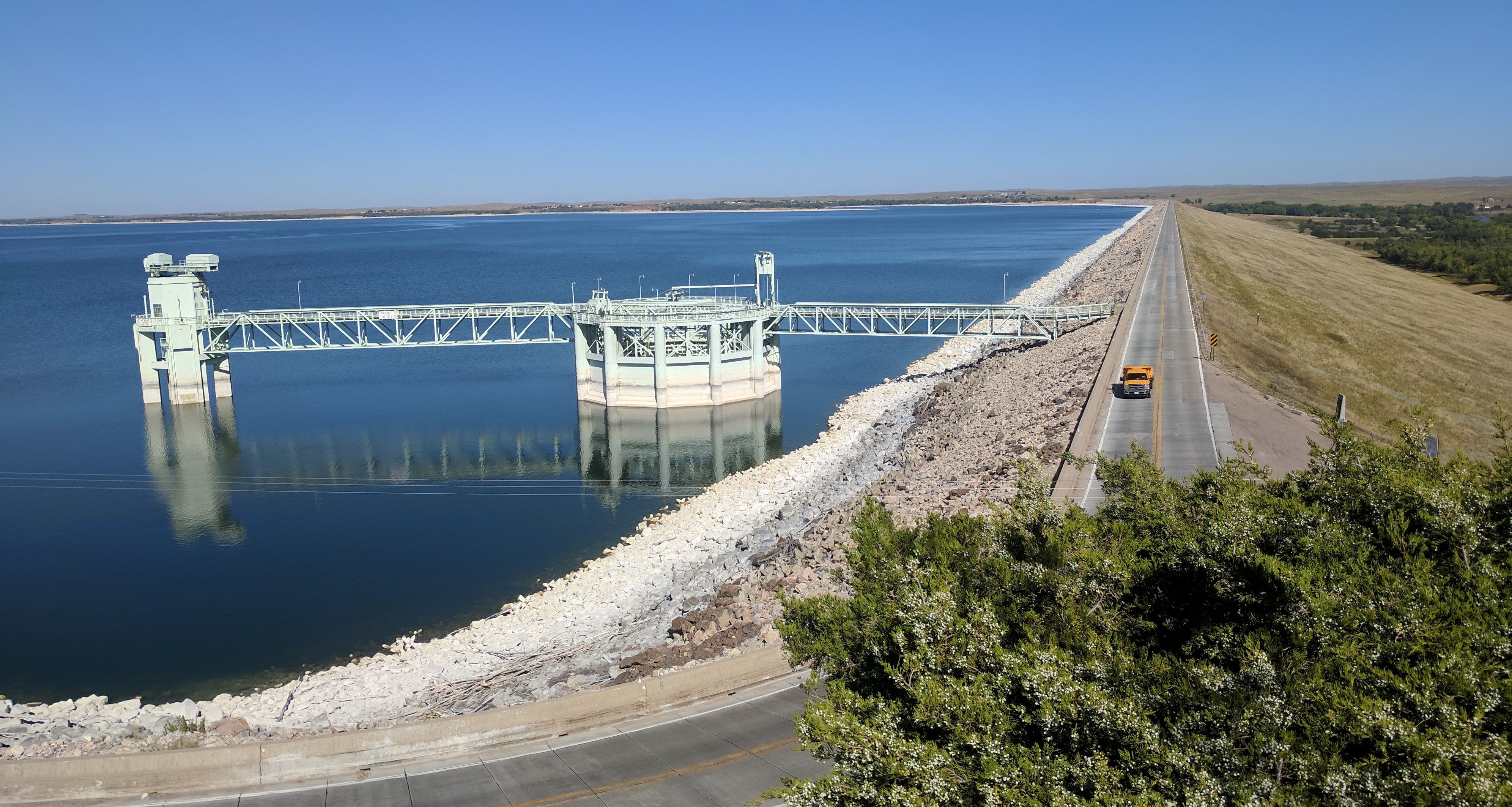
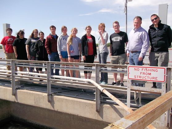
The final day of the tour dawned clear and warm, with little evidence left from the previous night’s storm.  The tour participants headed for the NGPC’s Lake McConaughy Visitors Center to browse through the facility’s Water Interpretive Center and listen to NGPC’s Regional Supervisor Colby Johnson explain the agency’s long-term Master Plan for recreational improvements at Lake McConaughy and Lake Ogallala.  After a little more than an hour, the group boarded the bus for a tour of “Big Mac’s” outlet structures (the Outlet Tower and the “Morning Glory” spillway) and the Kingsley Hydroplant below the dam.

Devin Brundage appears for the second time on the tour, this time as tour guide for the Kingsley Hydro. Here he explains the operation of the hydroplant’s bypass valve.

Most of the tourists had never had the opportunity to peer down into the great bowl of the spillway and a few backed away from the railing at the sight of the gaping hole through which huge volumes of water could be released if necessary to control the lake’s elevation during high-water events.  At the outlet tower, where the gates for normal releases of water lie at the bottom of the lake, no hands were raised when Central’s electro-mechanical technician Jason Meints explained the routine inspection process for the inside of the tower and asked for volunteers.  All it involves is a slow ride down the 160-feet-deep shaft on a flimsy platform attached to a steel cable in pitch darkness.  (To my surprise, I’ve never had anyone indicate an interest in going down the tower during similar tours, save for a few 15-year-olds who haven’t yet developed an aversion to dark and tight spaces.)

The group also enjoyed running … well, walking … several flights of stairs necessary to reach the generator floor and turbine-pit floor deep within the Kingsley Hydroplant.  Gothenburg Division Manager Devin Brundage, pulling double duty as a tour guide, explained the workings of the largest hydroplant in Nebraska and answered questions from tourists experiencing their first visit inside such a facility.

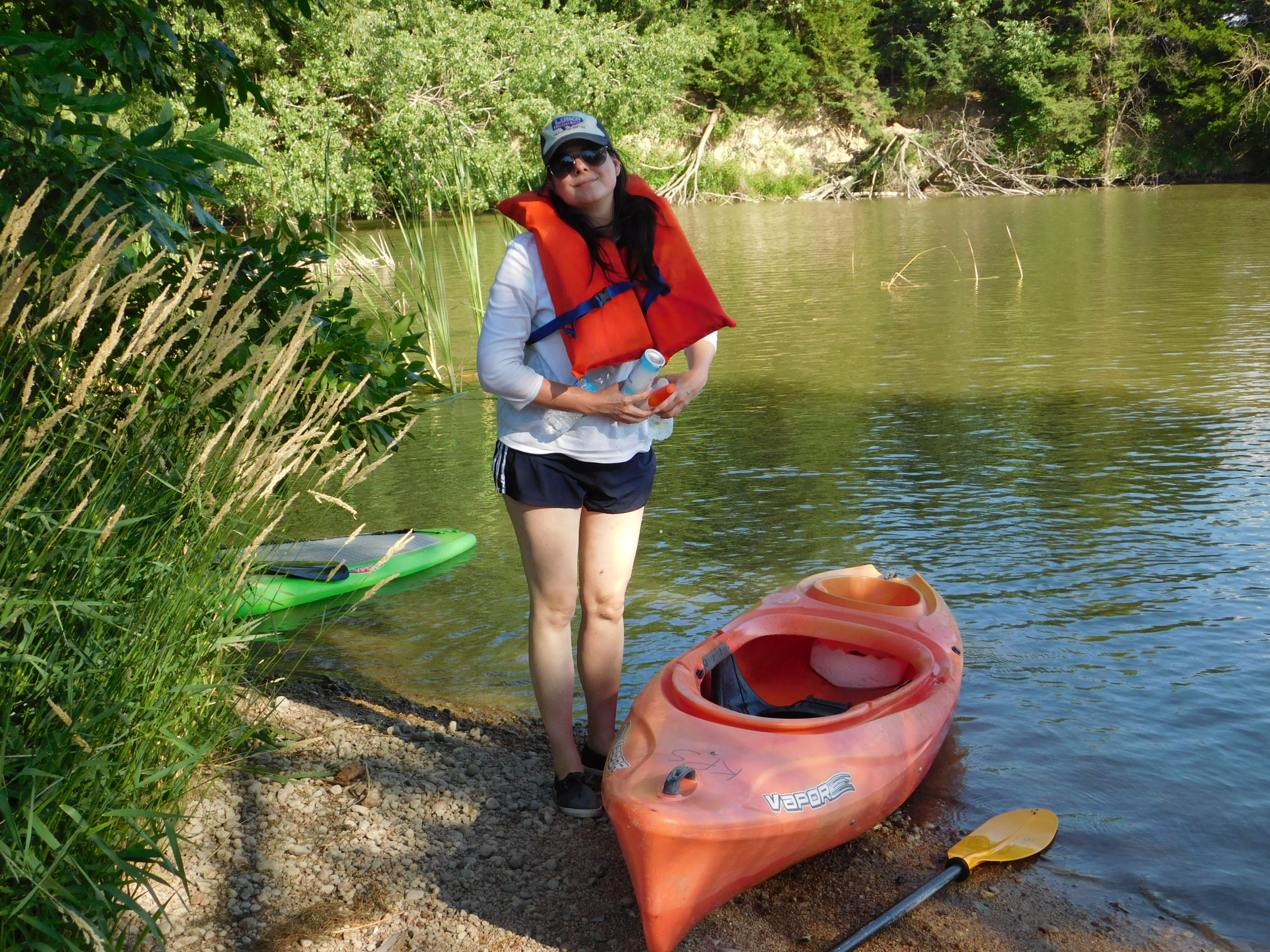
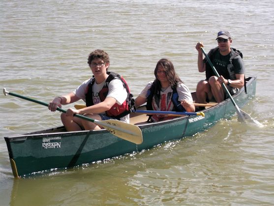
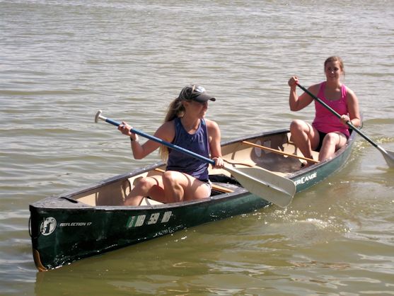
When the group members had regained their breath after climbing the stairs back into the sunlight, the tour continued down the road to Ole’s Big Game Bar & Steakhouse for a steak lunch, one more opportunity to fuel up for the final event of the tour:  a kayak trip down Central’s Supply Canal from just below Midway Lake near Cozad to the Gallagher Canyon Lake boat ramp, a stretch of 5.5 miles.

For most tour participants, it was their first opportunity to paddle a kayak, but everyone seemed to get the hang of the easily maneuverable crafts quite quickly.  Those who chose not to paddle boarded a john boat and a pontoon provided to follow along.  Since safety was a primary consideration, Jarrid Rickertsen – a Central employee at the Gothenburg office and a licensed emergency medical technician – piloted one of the boats and was prepared to use his EMT skills if necessary.  Thankfully, there were no emergencies and the kayakers arrived at their destination in about two hours.

Along the way, the group enjoyed the scenery along the canal.  High banks, plenty of birds, the occasional fish jumping out of the water or swimming just beneath, and a group of teenagers using one of the high banks as a platform from which they could jump/dive/flip into the canal 20 feet below.

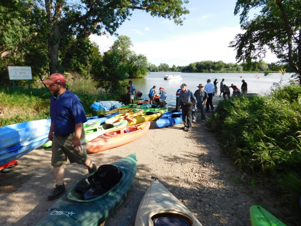
A tired, but triumphant group of kayakers climb the boat ramp at Gallagher Canyon Lake upon reaching the end of the 5.5-mile trip down Central’s Supply Canal.

Upon ending the kayak trip and re-boarding the bus, the tour concluded back in Holdrege with an impromptu pizza party in Central’s parking lot.  Three or four dozen pizzas disappeared in short order as the participants gradually departed for home, many of whom expressed their enjoyment of the tour and asked about the destination for next summer’s tour.

The organizing committee, composed of Steve Ress and Tricia Leidle from the Nebraska Water Center; Ben Beckman, research and extension communication specialist from UNL; and Public Relations Assistant Holly Rahmann and myself from Central, will convene soon for a debriefing session on this year’s tour and review comments and suggestions from surveys filled out by participants.  Then we’ll turn the page and begin planning for next year’s tour.  The destination is unknown at this time, but we’ll try to choose a tour that will be interesting and enlightening, and most importantly, fun for its participants, continuing a tradition 40 years in the making.

Central marks 75th anniversary of irrigation deliveries from Lake McConaughy

Central marks 75th anniversary of irrigation deliveries from Lake McConaughy

It was 1942.  Kingsley Dam had been closed the preceding year and Lake McConaughy was just beginning to fill.  In just under a year and a half, almost 840,000 acre-feet of water had been stored behind the dam.

This summer Central will reach a milestone:  75 years of delivering storage water from Lake McConaughy through its canal system.  In the irrigation service area (Gosper, Phelps and Kearney counties), farmers on almost 45,000 acres had signed contracts with Central for delivery of irrigation water. 

Although Central had been bringing water to the area since the spring of 1938 from a temporary diversion point on the Platte River east of Lexington, the deliveries were limited to about 3,300 acres near the river and functioned mostly as an opportunity for area farmers to learn how to best utilize water on their fields. 

Central sponsored demonstration days to show irrigation equipment and practices.  One such “irrigation school” of note was conducted on April 28-29, 1938 by Ivan Wood, an irrigation specialist from the University of Nebraska Agricultural College’s Extension Service.  Held at the Henry Peterson farm eight miles northwest of Holdrege, the school attracted an estimated 10,000 people over two days.  Wood demonstrated various instruments for leveling ground, making farm laterals, the use of canvas dams or light, steel dams for shutting off water or raising water levels in a lateral, the use of homemade lath box turnouts and how to distribute water over the field in the most practical manner.

Irrigation demonstration: Central District customers learned how to best use the newly arrived irrigation water on their farms. The first “irrigation schools” were held in 1938 on Phelps County farms and continued through the early years of the canals’ operations.

Corn yields jumped from an average of 28 bu./acre in the 1920s to more than 100 bu./acre on irrigated ground under improved farming practices during the 1940s.  The ability to irrigate was probably the most significant factor in increasing yields and producing a crop every year, even during dry periods.

But in 1942, there remained some uncertainty about how beneficial – and necessary — these new canals would be.  Most of the area had received decent rainfall during May and June, but – as often happens in Nebraska — July and August turned out to be hot and dry.  The new irrigation canals bringing water to the area proved to be a blessing for those who had delivery service contracts with Central.  Success bred success and by the end of the decade, the number of acres under irrigation doubled as more producers saw the advantages of irrigation.

A Central irrigation customer stands next to his farm lateral — equipped with wooden lath boxes through which water flowed from farm lateral to furrow (lower left corner) — and smiles at the good fortune of being able to irrigate his crops.

One such farmer was Laverne Johnson, who had started farming in the 1930s, right in the middle of one of the most brutal droughts Nebraska has ever experienced.  Johnson, who years later would serve two terms on Central’s board of directors, had been a supporter of the irrigation project during the struggle to gain approval and funds to build the project.  But from his perspective, he didn’t know if the project would be built in time to save him from ruin.

In the early 1990s, he recalled the difficulties he experienced during his first years of farming and the elation of seeing irrigation water come to his farm.

He explained that he was nearing the breaking point in the late ‘30s, having experienced crop failures and poor harvests time and again because of the lack of rainfall.

“I was almost to the point that I had to start thinking about another way to make a living, because I was just hanging on by my fingernails,” he said.  “I was excited when I learned that the project had been approved and would soon be built, but I still didn’t know if I’d be able to keep farming long enough for the water to get to me.”

Then he emotionally recalled the moment after the canals had been completed and he first saw water making its way down to his fields.

“I just dropped to my knees,” he said, “and cried like a baby because I knew at that point everything was going to be all right.”

And it was.  Over the years, Johnson would expand his farming operation, putting the additional acres under irrigation from the canals and later from wells as the groundwater table beneath the area began to rise because of recharge from the canal system.

Laverne passed away in 2001, but today the farm that he thought he was going to lose remains in his family largely because of the reliable source of water in Lake McConaughy that enabled him, and many others like him, to prosper instead of being driven from the land by the whims of nature.

UNK Research Students Complete 15th Annual Project Tour

UNK Research Students Complete 15th Annual Project Tour

Students from the University of Nebraska-Kearney had the opportunity to expand their knowledge of Nebraska’s natural resources during a tour of The Central Nebraska Public Power and Irrigation District’s hydropower-irrigation project on May 29 and June 1.

 
It was the 15th annual UNK tour, a milestone that demonstrates a commitment by several individuals who have been of UNK’s Summer Student Research Program (SSRP) over the years, perhaps none moreso than John Falconer, director of the Office of Sponsored Programs. Falconer has organized UNK’s participation in the tour of Central’s project each year since the tour’s inception, including making the trek to Lincoln to transport canoes for a trip down Central’s Supply Canal (more about that later).

 
The SSRP supports independent student research and scholarly activity each summer. It is open to students from all disciplines, and is structured to enrich the educational experience in several ways.

 
First, SSRP enables students to engage in original research and creative activity under the guidance of a faculty mentor. This opportunity to work closely with an expert gives the student a chance to expand their knowledge of a chosen academic discipline. Also, because the research is independent of a structured classroom setting, students experience the excitement and challenges of applying their knowledge and skills to solve problems. Finally, students draw on their general studies coursework and learn about research in other disciplines, broadening their understanding of the differences and connections between various fields of study.

Students and faculty mentors pose for a photograph atop the headgates of the Supply Canal near North Platte.

The tour of Central’s project provided students – most of whom had no background in agriculture or natural resources – a first-hand look at how water resources provide multiple benefits to Nebraska. The tour stopped at several sites and facilities within the District to see examples of these benefits.

 
The students first visited a site where irrigation water is applied to fields through a sub-surface drip system. The water is diverted from a small irrigation lateral through a filter system and then through buried drip lines to the crop’s root system. SDI irrigation is extremely efficient in that it reduces evaporation and deep percolation losses that may be present with other irrigation methods. Nitrogen fertilizer can also be applied through the system, literally spoon-feeding nutrients to the growing crop during the irrigation process. Producers employing SDI systems regularly see equal or better yields from SDI acres as compared to pivot-irrigated fields with generally less application of water.

Four to a wrench: Young ladies from the UNK Summer Student Research Program hoist one of the wrenches on hand for maintenance at the Kingsley Hydroplant. And it’s not even the biggest wrench!

The group also examined (briefly, because of a passing rain shower!) an example of “outside-the-box” thinking during a stop at a “drop-span” pivot system. The pivot, which can use either water from Central’s canal system, or from an irrigation well, is located on a half-section that includes obstacles that prevent the pivot from reaching a portion of the field. The solution, implemented by the producer and a local pivot dealer, was to install a pivot that allowed the producer to disconnect spans and towers to allow the pivot to reach more than 30 acres that were previously unable to be covered by the pivot. The pivot then reverses, stops at the location where the spans were dropped off, picks up the disconnected spans (with minimal labor by the producer), and continues over the rest of the field.

 
The group also stopped at a site that is part of the E67 Telemetry Project. The E67 Canal system includes three miles of membrane-lined canal; the rest of the delivery system was converted from open laterals to buried pipelines several years ago. Each turnout in the E67 area (approximately 6,000 acres) is equipped with UHF radio transmitters, digital flowmeters and rain gauges powered by and solar panels. Two automated weather stations measure wind speed and direction, temperature, relative humidity, net solar radiation, and precipitation to calculate evapotranspiration rates of the crops.

 
The data is transmitted to a base station at the nearby Johnson No. 1 Hydroplant and then via the internet to a McCrometer server where sorting and calculations are done. Field data and graphs can be picked up online by a producer’s PC, tablet or smartphone that has internet access.

 
The data allows precision irrigation management of these fields which saves water. Producers can start each morning with an up-to date view of graphs that show their field water balances. The information allows the producer to know where and when they need to start irrigating. Additionally, in a rain event, they will know total rainfall for the day, accumulated every 15 minutes on each field (or a nearby one) and know which irrigation systems can be shut down immediately or if they should keep running through a small rain event. There should never be water stress on a field again.

 
Additional components are available and producers have the option to add such equipment as pressure gauges, soil moisture probes, pivot lateral position, etc. The E67 Telemetry Project came about as a cooperative venture by Central, McCrometer, UNL Extension and the Nebraska Environmental Trust Fund.

 
From there, the group journeyed to the Jeffrey Island wildlife habitat area, a 4,000-acre area owned and managed by Central for the benefit of wildlife. Dave Zorn, Central’s senior biologist, explained the management process and how Central has worked over the years to convert pastureland beset by musk thistle and other noxious weeds into suitable habitat for various species of birds, reptiles, amphibians and mammals.

 
The next stop was at the Gothenburg Control Center, where Gothenburg Division Manager Devin Brundage explained how the vast system is remotely and automatically operated from the Control Center, moving water almost 200 miles through a series of canals, lakes, pump stations, pipelines and hydroplants from Lake McConaughy to east of Minden.

 
The students then stopped at the Jeffrey Hydroplant near Brady to learn about the clean, renewable generation of electricity at one of the four hydroplants on Central’s system.

 
After a delicious catered dinner at Jeffrey Lodge, the students spent the night at the lodge to rest up for a second full day of exploration, education, and physical exertion.

 
Early the next morning, the group departed for Lake McConaughy where Kingsley Dam Foreman Nate Nielsen guided them through the Nebraska Game and Parks Commission’s Water Interpretive Center, the outlet structures for Lake McConaughy and the Kingsley Hydroplant.

Nate Nielsen (top right, gray shirt), Central’s Kingsley Dam foreman, explains the workings of the Kingsley Hydroplant to UNK students and members of a second tour group from Dawson County.

After lunch, the group set out for their final stop, a point just below Midway Lake, to conclude the tour with a 5.5-mile canoe trip down the Supply Canal to the Gallagher Canyon Lake State Recreation Area. For many, it was their first opportunity to paddle a canoe and, despite some inexperience and subsequent sore muscles, the trip was completed in less than two hours.

We made it! Two UNK students reach the boat ramp at Gallagher Canyon State Recreation Area after a 5.5-mile canoe trip down the Supply Canal.

To recap, the students saw examples of efficient crop irrigation, wildlife habitat, renewable energy generation, recreation and groundwater recharge.

 
Student participants on the tour were Molly Dibben, Stephanie Paulsen, Audrey Codina, Luke Hamilton, Sidney Trenhaile, Nathan Ott, Gamaliel Alcaraz, Sarah Strawn and Kendall Schumacher. Faculty mentors included Dr. Peter Longo, political science professor and interim dean of the College of Natural and Social Sciences; Dr. Mark Ellis, professor and chairman of UNK’s history department; and Dr. David Vaile, assistant professor of history.

NCTA Students Tour Part of Central’s Project

NCTA Students Tour Part of Central’s Project

Another group of students from the Nebraska College of Technical Agriculture in Curtis recently visited Kingsley Dam and Lake McConaughy.

Brad Ramsdale, PhD, professor of agronomy at NCTA, accompanied the students as he has several times in the past.

The group first listened to a presentation by Nate Nielsen, Central’s Kingsley Dam foreman, about Central’s hydro-irrigation project before the group visited the Nebraska Game and Parks Commission’s Water Interpretive Center where they learned about the various uses and importance of water.

After viewing a video that detailed the construction of Kingsley Dam and a five-minute audio presentation about water resources in the Platte River Basin, the group headed out to get a first-hand look at the “Morning Glory” spillway and the Control Tower, the outlet structures for Kingsley Dam. The group also toured the Kingsley Hydroplant where Nielsen described in detail the operation of the state’s largest hydroelectric plant.

Kingsley Dam Foreman Nate Nielsen explains the operation of the Kingsley Hydroplant to NCTA students.

After leaving Lake McConaughy, the students stopped at Paxton to observe the “Big Cut” through the hills north of the town and NPPD’s siphon that conveys water from the North Platte River into the South Platte basin.  The group then enjoyed lunch at Ole’s Big Game Bar and Restaurant.

The day concluded with a stop at Central’s Gothenburg Control Center where Gothenburg Division Manager Devin Brundage briefed the group on the operation of Central’s supervisory control and data acquisition system (SCADA) that controls and monitors flows in the Supply Canal and irrigation canals, generation at four hydroplants, and many other aspects of Central’s hydro-irrigation project.

Central thanks the group for visiting and looks forward to future visits by Dr. Ramsdale’s students.


1 2 3 4
Facebook
Twitter
LinkedIn
Instagram