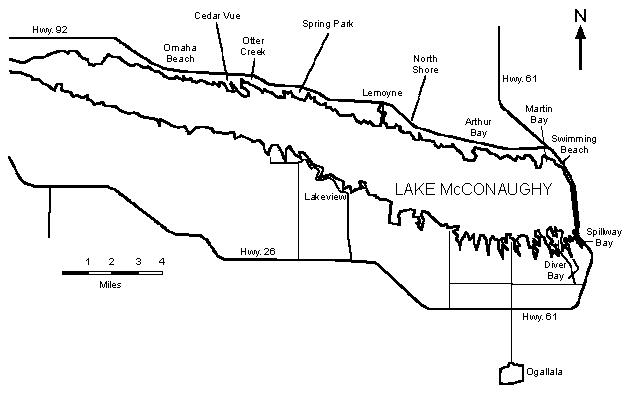
Figures listed below are the elevation at the end of the boat ramp. The ramp is in service when Lake McConaughy’s elevation (in feet above mean sea level) exceeds the end-of-ramp elevation sufficiently to allow boaters to launch their boats. In most cases, allow an additional 3 to 4 feet to ensure adequate clearance and safe use of the ramp. See map below for boat ramp locations.
| Boat Ramp | End-of-Ramp Elevation |
|---|---|
| Otter Creek (flume) | 3,258.0 |
| Otter Creek (bay) | 3,241.5 |
| Omaha Beach | 3,252.0 |
| Cedar Vue (bay side) | 3,236.9 |
| Spring Park | 3,250.0 |
| Martin Bay (south half of ramp) | 3,234.0 |
| Spillway Bay (back) | 3,249.0 |
| Cedar Vue (lake side) | 3,233.8 |
| Lemoyne (bay side) | 3,245.0 |
| Spillway Bay (front) | 3,233.0 |
| Arthur Bay | 3,244.8 |
| Lemoyne (Admiral's Cove, lakeside) | 3,230.0 |
| Martin Bay (north half of ramp) | 3,244.0 |
| Diver's Bay | 3,210.0 |