Kingsley Hydro Inspection: Images from the Inside

Kingsley Hydro Inspection: Images from the Inside

The accompanying images reveal parts of the Kingsley Hydroplant that are seldom seen by anyone other than Central employees who perform regular inspections, maintenance and repairs at Nebraska’s largest hydropower plant.

Central’s engineers and maintenance crews take the plant off-line annually for regular inspection and maintenance of the facility’s mechanical and electrical components, but every five years the 19-feet-diameter penstock leading from the Control Tower in Lake McConaughy and the scroll case which routes the water through the turbine are de-watered for complete inspections.

Once the gates on the Outlet Tower and the huge guard valve within the hydroplant are closed, preventing water from Lake McConaughy from entering the plant, pumps removed water from the penstock so a two-man crew can paddle a small rubber boat up the penstock to the base of the Outlet Tower to perform the inspection. (In addition, Central personnel take a larger aluminum boat – with a motor — up the 28-feet-diameter penstock from the “Morning Glory” spillway to inspect the inside of that pipe.)

Being inside the huge scroll case, which is a spiral-shaped intake tube that routes water entering from the penstock through the wicket gates just above the turbine blades, is not a place for someone with claustrophobia. First, it’s pitch dark until portable lights are turned on to enable the inspection process. Second, one arrives (either immediately or eventually) at the realization that you are well below the bottom of Lake McConaughy and only several inches of steel separate you from almost 2 million acre-feet of water on the other side.

But for the men doing the inspections, it’s all in a day’s work.

The wicket gates that control the flow of water falling over the turbine blades. The gates move along a vertical axis.

The wicket gates that control the flow of water falling over the turbine blades. The gates move along a vertical axis.

View from below the turbine hub, with blades and closed wicket gates visible.

View from below the turbine hub, with blades and closed wicket gates visible.

Close-up view of one of the stainless steel turbine blades.

Close-up view of one of the stainless steel turbine blades.

The turbine hub with scaffolding erected to facilitate inspection and maintenance work.

The turbine hub with scaffolding erected to facilitate inspection and maintenance work.

The guard valve between the penstock and scroll case.  The valve is 19 feet in diameter.

The guard valve between the penstock and scroll case. Although it doesn’t appear very large in the photo, the valve is 19 feet in diameter.

Joel Hull: Forgotten Pioneer

Joel Hull: Forgotten Pioneer

Forgotten Pioneer

This year The Central Nebraska Public Power and Irrigation District is marking the 75th anniversary of the completion of Kingsley Dam in 1941. The stories about George P. Kingsley and C.W. McConaughy, two of the most prominent men in the creation of the hydro-irrigation project, have been well documented. However, the story of another pioneer who sought to bring hydropower and irrigation to south-central Nebraska, has been largely forgotten.

Joel Hull was educated in Ohio as a lawyer, served as an officer in General Crook’s brigade during the Civil War and then entered the tannery business after the war. However, he soon became intrigued by the promises of cheap land, plentiful resources and the opportunity to make a fortune in the new land being settled “out west.” Some may have called him a speculator or a “Boomer,” but it could certainly be said that he was ambitious.

He sold his tannery and moved to Nebraska in 1872. He settled first in Lowell in Kearney County, which then consisted of about six buildings and a handful of surrounding farms. He staked out a claim and started farming the virgin prairie, but he was never content as a farmer. He had bigger dreams.

One of his first efforts – along with others who shared his way of thinking — was to move the county seat from Lowell, through which the railroad ran, to a little town in the center of the county that consisted of little more of than a post office operated by an old German immigrant. The immigrant had named the place Minden after his old home town in Germany.

The people of the county approved the move of the county seat in 1876, although a court injunction delayed the official designation of Minden as the county seat until 1878. By then, a courthouse had been built, lots laid out, and a school and hotel were under construction. By 1880 there were 200 people living in Minden and 300 by 1882. The boom came in 1883 when the Burlington and Missouri Railroad laid tracks through the town and by the end of 1883, 1,200 people called Minden home.

Still Hull was not content. He and others who were encouraged by the rapid growth of their town had much bigger ambitions. In 1887 he proposed a canal to produce hydropower to turn the wheels of commerce and power Minden’s future. In 1889 he formed the Nebraska Canal and Improvement Company which had a charter befitting his ambitions. The company was to be involved in real estate, town-building, flour mills, steel mills, foundries, machine shops, grain businesses, rolling mills, city water works, wagons and carriages, and of course power plants to run the factories and businesses. Irrigation canals would serve the surrounding farms. The company would oversee the growth of a “Minneapolis on the Plains.”

Hull contracted with surveyors to plot the course of his power canal. They produced plans for a 54-mile-long canal from near the mouth of Plum Creek on the Platte River north of Bertrand to Sand Creek near Minden. The plans for the canal would have followed a very similar route chosen in the late 1930s for Central’s Phelps Canal. All he needed was $150,000 to build the canal.

But that’s as far as he got. No record of funds being raised or dirt being turned exists. Drought in the early 1890s was already forcing people out of the area as crops and businesses failed. When the Santa Fe Railroad abandoned plans to build a railroad through Minden to the Black Hills, his dream suffered another serious blow.

But Hull wasn’t ready to give up. He revived his plans on a smaller scale in 1894. His canal would still produce hydropower, but would have more of a focus on irrigation. But the years 1895 to 1898 were wet years that made people forget the need for irrigation. Even two more years of drought in 1899 and 1900 could not convince people of the need for irrigation.

However, between 1906 and 1915, average annual precipitation in the Kearney County area declined yearly. Hull died in 1914, and by then others had become convinced that the area could not prosper without a reliable supply of water to offset nature’s whims.

In 1913, C.W. McConaughy, mayor of Holdrege and a grain merchant was driving through the fields north of Holdrege on what was known as the Elm Creek road. He spotted a wheat field that had an odd look to it. In some areas the wheat grew tall with full heads of grain; in others, the wheat was stunted and with sparse heads.

Upon locating the owner of the field1, McConaughy learned that the field had been previously planted to corn. During harvest, the corn had been put up in shocks to dry. Subsequently, snow had collected around the shocks. When the snow melted, the water soaked into the ground. It was in these areas that the wheat grew best.

An idea was born, an idea that would eventually lead to the construction of The Central Nebraska Public Power and Irrigation District’s hydro-irrigation project.

The rest, as they say, is history.

  1. The farmer was most likely O.T. Anderson, a supporter of the “Tri-County Project,” as it was then known, and later a member of CNPPID’s board of directors. He was identified in a March 21, 1938 article in the Holdrege Daily Citizen. In an interview with Moritz Aabel, who became a long-serving member of Central’s board, Mr. Aabel recalled mention by McConaughy of returning from a trip to Elm Creek during which he noticed the field. Such a route would have taken him past Anderson’s farm.

E67 Telemetry Project Begins Second Year

E67 Telemetry Project Begins Second Year

Centralized Water Use Database for Irrigation Water Management in CNPPID
by Marcia Trompke, CNPPID Conservation Director


Site 4

     Producers taking water from Central’s E67 Pipeline Canal are involved in our newest precision management pilot project; funded in part by Nebraska lottery dollars through the Nebraska Environmental Trust, McCrometer Inc., Central and Nebraska Extension.  McCrometer’s Steve Grove (Hemet, CA) and Paul Tipling (Salina, KS), came to NE last week to help Central staff install equipment at 25 new field sites.  These sites, added to the 2015 installations, bring total sites in the project to 51.  In addition, a third McCrometer weather station was set up next to an existing UNL station to compare measured weather data and the results of the evapotranspiration calculations from each unit.

20150615_141111
Each project site using water from E67 has been fitted with a UHF radio/solar panel set and a digitizer added to the existing flowmeter.  Most sites have a digital rain gauge unless pivot water will hit it.  A gateway unit at the powerhouse near Johnson Lake calls each field station every hour and each weather station every 15 minutes to gather data and transmit it to a host computer at McCrometer.  Producers have access to this information from each of their fields and the weather stations immediately from a home computer, tablet or smartphone.  Data is graphed, tabled and archived for producers and all data is exportable to an Excel spreadsheet.

flow meter 6  The outcome of precision management is expected to be high yields with minimum use of irrigation water.  It is possible that an irrigation event can be saved at the beginning or end of the season or both once the producer has reliable information on hand to make those decisions.

***

Other info:

  • The E67 Canal headgate is on the outlet side of Johnson Lake and the canal provides irrigation water to 5,767 acres to the south.
  • In 2001 and 2002, the E67 earthen canals were upgraded to 18.2 miles of pipeline, 2.9 miles of membrane lined canal (bank to bank) and a 0.4 mile lateral was left open. The project saved 5,000 AF of seepage and evaporation losses annually; storable water that can enhance aquatic and shoreline habitat at Lake McConaughy.
  • The E67 Telemetry Project is an upgrade on the customer side of the meter; an effort to help customers raise the efficiency of crop water use.
  • By having reliable information on the soil water balance in every field, producers are able to determine daily which field(s) need an irrigation.
  • The ability to see the amount of rainfall measured at the weather stations in 15 minute intervals, allows producers to determine if they need to irrigate through a light rain or shut a pivot down.
  • Data is available 24/7 from anywhere in the world
  • Central will allow producer purchased add-ons to be integrated into this system. Pressure sensors, soil moisture sensors and pivot locators are some of the possibilities.
  • Central will be able to see individual and aggregated deliveries throughout the season and by 2017, should be able to integrate the meter data directly into the accounting software for billing.
  • 2017 will be Year 3 of this project when all remaining turnouts will be included in the Telemetry system.
  • NET is providing 3 years of funding, $194,100 total as a cost share grant
    • 1 (2015), $61,380
    • 2 (2016), $65,460
    • 3 (2017), $67,260
    • McCrometer, Inc., Central, NE Extension share of the total project is $ 226,540
  • NET grants are funded from the NE Lottery; that return dollars to local communities to help fund improvement projects from these categories;
    • Habitat
    • Surface and Ground Water
    • Waste Management
    • Air Quality
    • Soil Management

University of Nebraska Kearney Students Visit J-2 Eagle-Viewing

University of Nebraska Kearney Students Visit J-2 Eagle-Viewing

Midway Point in the J2 Eagle Viewing Season

Post by Mark Peyton – CNPPID Senior Biologist

February 1st marks the mid-point in the eagle viewing season at Central’s J2 Power plant located south-east of Lexington.   So far this has been an excellent season with both consistent numbers of eagles and quite a few visitors.

To date over 1,000 people have signed the registration book averaging over 45/day.   They have been treated to about 25 eagles that are actively fishing, flying, and interacting with each other.   The viewing center is open through February on Saturdays and Sundays from 8:00 AM – 2:00 PM.

Shown here is Dr. Letitia Reichart’s Ornithology Class from the University of Nebraska-Kearney.

unk1 unk2

2014-15 Water Year Inflows Exceeded “Normal”

2014-15 Water Year Inflows Exceeded “Normal”

In the wild and wacky world of water, a review of data from the 2014-15 water year (which ended Sept. 30), is an interesting – if not particularly enlightening — exercise, as I’ll demonstrate below. It’s difficult to know what, if any, conclusions can be drawn.

The 2014-15 water year ended up as the 11th highest in terms of inflows to Lake McConaughy (see table below), which means it ranked above “normal.”

“Normal” inflows, depending upon how you choose to look at them, are either understood to be the “average,” (or “mean”), which is a number that is calculated by adding quantities together and then dividing the total by the number of those quantities; or the “median,” which is defined as “the value in the center of the distribution for an array of data.”

One problem with using the average to define “normal” is that the values can be skewed by very high or very low data.  Those impacts, of course, are lessened as the data set grows larger.

So perhaps we should use median annual inflows, which produces a number right in the middle of the data set, as an indicator of “normal.”

But is that really “normal?” What, indeed, is “normal?”

According to Webster’s Dictionary, the definition of normal is “conforming to the standard or the common type; usual; regular; natural.”

Hmm. Not sure that’s helpful, particularly given the unpredictability of Nebraska’s weather and water supplies in the Platte River watershed.

Perhaps the second definition in the dictionary would be more appropriate: “Serving to establish a standard.” That might be more helpful as we seek conditions that conform to expectations.

For the sake of comparison, the historical median annual inflow into Lake McConaughy through the recently ended water year is 913,234 acre-feet. But the average annual inflow over that period is 1,020,504 acre-feet, which is a difference of 107,270 acre-feet, or almost 12 percent. For perspective, that’s like getting another October’s worth of inflows during a year, and October is historically the month when inflows, on average, are the highest.

But let’s take a look at another set of numbers, just for fun, of course. We’ve mentioned that the historic median annual inflow is 913,234 acre-feet. That’s over a period of 74 years. If we look at the median inflow over shorter periods of time, we find the following: The 30-year median – back to the 1985-86 water year – is only 758,071 acre-feet; the 10-year median is even lower at 723,595 acre-feet, but the 5-year median – bolstered by a couple of good water years and offset by a couple of below normal (there’s that word again) years – is 819,673 acre-feet, although still significantly less than the historic median. Does that mean that “normal” is a moving target, that it changes with time and circumstances? How can something so transient be referred to as “normal?”  Can “normal” change?  (Well, obviously.  It’s no longer considered “normal” to wear “disco” outfits, but that’s another story.)

So again we have to ask, “What is normal?” One of my favorite answers to this question, which I find fitting given weather on the Great Plains, is that normal is somewhere in the middle of two extremes. If that’s the case, then the only years when inflows to Lake McConaughy ended up in the “normal” range were 1957-58 when inflows were 916,900 acre-feet, or perhaps 1977-78 when inflows were 909,567 acre-feet.

After all that, it appears that we’ve only had two years of “normal” inflows in the last 74 years!

So when looking at inflows to Lake McConaughy, I guess you could use the saying from the movie “Forrest Gump,” when the title character’s mother advised him: “Life is (substitute “Inflows are…”) like a box of chocolates; you never know what you’re going to get.”

Top Twenty Water Years
Water YearAcre-Feet Inflow
1 . 2010-112,627,556
2. 1983-842,603,167
3. 1982-832,358,867
4. 1972-732,218,404
5. 1970-712,052,372
6. 1973-741,693,349
7. 1985-861,658,226
8. 1998-991,477,213
9. 1996-971,460,295
10. 2009-101,453,595
11. 2014-151,321,203
12. 1946-471,244,041
13. 1951-521,243,043
14. 1944-451,218,007
15. 1941-421,215,860
16. 1971-721,214,752
17. 1986-871,210,589
18. 1979-801,177,316
19. 1950-511,170,919
20. 1947-481,159,208
The “Bottom Ten”
Water YearAcre-Feet Inflow
10. 1960-61624,960
9. 2007-08609,533
8. 2012-13601,230
7. 1955-56597,654
6. 2004-05548,569
5. 2001-02544,574
4. 2005-06494,155
3. 2006-07477,645
2. 2002-03455,731
1. 2003-04440,900

(Note that nearly all of the inflow years that populate the “Bottom 10” occurred recently, during the first decade of the 21st century.)

Elwood High School Science Club Tours Project

Elwood High School Science Club Tours Project

As the public relations coordinator for The Central Nebraska Public Power and Irrigation District, I’ve led countless tours of the District’s hydro-irrigation project over the past 25 years. But unless my memory fails me – always a distinct possibility – I’ve never had the pleasure of hosting a group of high school students on a two-day tour.

That was the case on Oct. 6 and 7 when students from the Elwood High School science club participated in a tour. It was wonderful to have a group of kids who are so obviously invested in and serious about learning.

The Elwood Science Club is one of only three such clubs in Nebraska to gain certification by the American Chemistry Society. The club’s mission to motivate and encourage high school students to explore the many ways that chemistry is used in their everyday lives. It also provides hands-on opportunities for members to experience science beyond what is taught in the classroom; learn about career opportunities in the many and varied fields of science; provide service for the betterment of their community; and develop leadership and communication skills.

Look_under_water

Members of the science club get an “under water” look at the fish and wildlife display in the Water Interpretive Center.

Led by science teacher Chelsey Neville, the students were enthusiastic about the tour and eager to learn more about water, hydroelectric power, wildlife and agriculture in Nebraska.

The first stop on the tour was at Elwood Reservoir, a site very familiar to most of the students because of its proximity to their home town. The group then traveled to a site along the E67 Canal to learn about the new telemetry project and automated weather stations that provide real-time data on-line to irrigation customers to improve water management.

Mark_Peyton_and_bullsnake

Biologist Mark Peyton competed with a big snake and a little puppy for the students’ attention.

The next stop was the Jeffrey Island wildlife management area where Senior Biologist Mark Peyton met the group. Peyton explained how the 3,000-acre tract of land in the middle of two channels of the Platte River is managed by Central as wildlife habitat. In addition to habitat work to benefit shorebirds, cranes, migratory song birds, reptiles and insects have been studied on the island, as have methods for controlling unwanted vegetation.

Peyton, perhaps mistakenly, brought a companion to the island: his nine-month-old Labrador puppy. In the competition for the students’ attention, Peyton probably came in second to the cute, bouncing bundle of energy named Luna, although he probably salvaged the day by pulling a four-foot-long bull snake out of a bag and allowing some of the more intrepid students to handle the reptile.

Chelsey_student_and_bullsnake_Jeffrey_Island

Teacher Chelsey Neville seems a little less enthused about the snake than one of her students.

Following a stop at the Johnson Lake inlet and E65 Canal head gate, the group enjoyed lunch in Gothenburg’s Country Barn & Grill and then visited the Gothenburg Control Center. Electrical Superintendent Devin Brundage discussed Central’s supervisory control and data acquisition (SCADA) system, explaining how technology has increased the efficiency of District hydropower and irrigation operations. He also complimented the students for their interest in science and encouraged them to pursue additional education and careers in fields related to science.

The next stop was Central’s diversion dam on the Platte River just east of the city of North Platte, followed by a visit to the Jeffrey Hydroplant where their tour guide was urged to save an unidentified species of snake (what is it with snakes showing up over and over?) from a watery grave in the hydroplant’s tailrace. The group then enjoyed an excellent catered dinner provided by the BBQ Company and John and Jenice Jordening of Lexington.

The group asked about rumors that Jeffrey Lodge was haunted by some long-dead and unknown spirit or spirits. Unfortunately, I could not confirm those rumors, which actually seem to have disappointed some of the students. I’ve stayed overnight at the lodge dozens of times and have never seen, heard, or felt anything out of the ordinary. But then again, I was apparently unable to dispel the rumors either. One of the boys claimed that he saw “a head or something” outside his bedroom window before turning in for the night. It was enough to make him sleep with some lights on.

See the “spectral image” in the upstairs window?*

Jeffrey_Lodge

* It’s (probably) a reflection from the ceiling lights in the dining room.

Big_wrench

Ready to go to work at Kingsley Hydro.

On the next morning, after a quick breakfast, the group traveled to the Lake McConaughy Visitors and Water Interpretive Center where Kingsley Dam Foreman Nate Nielsen educated the students about operation of the dam and hydroplant. The walk out onto the reservoir’s huge control structures was a hit with the kids and the trip up and down several flights of stairs at the hydroplant did little to diminish their energy, apparently only whetting their appetites for lunch at Ole’s Big Game Steakhouse and Grill. Then it was back on the bus and back to Elwood High School where, as Mrs. Neville informed them, a quiz related to information learned over the past two days would await them in the near future.

Elwood_HS_Morning_Glory

Members of the class look down into the “Morning Glory” spillway.

That announcement drew a few groans, but I’ll be surprised if the students didn’t all “ace” the quiz.

Summer Tech Will Treasure Experience for a Lifetime

Summer Tech Will Treasure Experience for a Lifetime

The experience of working at Lake McConaughy is something I’ll hold onto for the rest of my life.

I spent a second summer at Lake McConaughy working as a biological technician for The Central Nebraska Public Power and Irrigation District. The gorgeous landscape that surrounds the huge lake is remarkable and the white sandy beaches make the lake unlike any other I’ve seen. The sandy shorelines make an excellent destination for campers and outdoor enthusiasts from all over, but people are not the only ones utilizing the beaches.

Piping plovers and least terns are small shorebirds that also call Lake McConaughy home during the summer months. These magnificent birds are ground nesters and the fine sandy beaches of Lake Mac make the perfect habitat in which to hide their eggs. But because the birds share their nesting sites with people who are enjoying the lake, their nests are in danger of accidental destruction from getting run over, stepped on, or destroyed by unleashed pets. This is where my job becomes important.

Plover eggs in a nest, a small scrape in the sand, exhibit the camouflage that provides protection. Photo by Dillon Schroeder.

During the early months of the summer – late May and June — a typical day for me would be to survey the beach, searching for plover and tern nests and eggs, which is more difficult than one might imagine. The eggs are slightly smaller than a quarter and blend into the sand extremely well, which is the reason they nest in open, sandy places.

Once a nest is located, certain actions must take place to ensure that it has the greatest possible chance of producing eggs and chicks. In areas where human traffic is heavy, an enclosure is constructed around the nest, consisting of orange flagging and signs to make it as visible as possible to beach-goers. The enclosures are large enough that the bird will feel comfortable sitting on the nest as people drive or walk by. In certain areas around the lake where nests are more frequently established, a much larger enclosure is built. These enclosures could have more than ten nests inside them, and make it possible for the birds and chicks to go all summer without human interaction. As the summer progresses, the eggs begin to hatch and then comes the difficult task of keeping track of all the chicks on the beach until they are old enough to take flight. This can be difficult as the chicks can roam a great distance in either direction in a single day. However, this summer was much different than last.

Early in the summer, we had many much needed rain showers, causing flows in the North Platte River to rise dramatically. This meant a high volume of water flowing into the lake, which raised its elevation by more than a foot a week. The beaches rapidly disappeared as the birds were trying to find a suitable spot to make a nest. Just as the birds would find a site, the location would become inundated by the rising lake. As days passed, more and more birds left the lake in search of different locations to nest. By the end of the July, which is the natural deadline for these birds to make a new nest, we had no successful nests as the lake rose to 97 percent of its capacity. All suitable habitats were covered by water and the birds were forced to leave without having a successful nesting year at the lake. However, these birds tend to be resilient and will surely be back next year to give it another go!

This summer at the lake was one of the most interesting experiences I have had. Watching how the birds reacted to the water rising and seeing them battle each other for territory on what little beach remained was a sight unlike any other. This summer also showed me just how much natural changes can affect the entire ecosystem of the lake. Not only were the birds forced to leave without successfully nesting, but people had to find other areas to park their campers or pitch their tents , which was quite a sight to see. The fishing at Lake Mac quickly became more challenging as the summer went on. As the lake expanded, so did the areas in which fish could forage or take cover. Watching how fisherman reacted and tried new tactics was also interesting to me, as I am an avid fisherman.

All in all, one of the most important lessons I learned this summer is that things don’t always go as planned, but you have to be ready for whatever happens and learn to adapt to the situation that you encounter. I am thankful I am able to come away from this experience with such an important life lesson!

— Tony Jenniges is a senior at the University of Nebraska-Kearney, majoring in wildlife management with plans to enter a master’s program in the same field. He has worked two summers for Central, as well as a summer internship with the Nebraska Game and Parks Commission. He also has worked for Headwaters, Inc., on tern and plover monitoring at sandpits in the central Platte River area as part of the Platte River Recovery Implementation Program monitoring efforts. In addition, he has participated in whooping crane monitoring by airplane, also a part of the PRRIP monitoring program.

The Supply Canal: Scenic Canoe Trips Await

The Supply Canal: Scenic Canoe Trips Await

Can you identify the locations of these photos?

Supply_Canal_Photo_1(a)Supply_Canal_Photo_3a

SUPPLY_CANAL_PHOTO_5a

No, they weren’t taken along a wild and scenic river, or at some national park. These photos were taken along Central’s Supply Canal, which runs from just east of North Platte to east of Lexington. Many sections of the canal wind through high banks, and narrow canyons.

The public is permitted to use the entire length of the canal for recreational purposes, excluding areas around Central’s three hydroelectric plants and NPPD’s Canaday Steam Plant. Portages around check structures are relatively easy, but getting around the hydroplants requires a lengthier overland trek. Launching a canoe or kayak may be difficult in some spots because of the shoreline protection materials (in most cases, broken concrete riprap). Many sections of the canal are paralleled by maintenance roads or state and county roads. The flow in the canal is relatively constant year-round, the water is 15 to 20 feet deep in most places, and the current is not rapid (no whitewater stretches), although caution should be exercised when approaching check gates.

The 75-mile-long Supply Canal and its many canyon lakes are used for hunting, hiking, canoeing and kayaking, camping and fishing. Only wakeless boating is allowed on the canal to prevent bank erosion.

Also, when planning a canoe or kayak trip, it’s a good idea to remember these helpful hints from the Nebraska Game and Parks Commission:

  • Wear your life jacket.
  • Take a spare paddle.
  • Don’t canoe alone.
  • Have tether ropes on both ends of the canoe.
  • Take insect repellant.
  • Take ample water.
  • Take sunscreen, sunglasses, and wide-brim hat. The sun’s reflection off the water can be intense. If it is hot, start early or later in the day and make the trip shorter.
  • Put extra clothing, gear, and food in water-proof bags.
  • Take rain gear, but not ponchos.
  • Take first aid kit. Learn what poison ivy and poison oak look like, as well as black widow and brown recluse spiders.
  • Avoid contact with livestock and wild animals.
  • Protect your feet with tightfitting wading shoes.
  • Camp only in designated areas. Obtain permission prior to camping on, or entering the water from, private land.
  • Read maps and plan ahead. Be off the water before dark.
  • TRASH: If you create it, e.g., cans, bottles, food wrappers, etc., pack it out. Don’t discard it in the water.
  • Build fires only in fire rings; drown flames and coals after use. If no fire ring exists, use only camp stoves.
  • Use caution when loading and unloading near highway or county bridges.
  • And remember, Nebraska’s weather can be unpredictable and prone to extremes of temperature, humidity, wind and rate of change. Summer storms rapidly form, are fast-moving and can have rain, hail, high winds, lightning, and tornados combined.  Pay attention to signs of bad weather, get off the water and take cover as quickly as possible if a storm is approaching.

National Dam Safety Awareness Day is May 31

National Dam Safety Awareness Day is May 31

National Dam Safety Awareness Day occurs on May 31 of each year to commemorate the failure of the South Fork Dam in Johnstown, Pennsylvania in 1889. The dam failure resulted in the loss of more than 2,200 lives and is the worst dam failure in terms of fatalities in the history of the United States.

Photo courtesy of National Park Service

Aftermath of Johnstown Flood. Photo courtesy of National Park Service

National Dam Safety Awareness Day was created to encourage and promote individual and community responsibility for dam safety, as well as to provide information on what steps can be taken to prevent future catastrophic dam failures. A secondary goal is to promote the benefits dams offer to communities.

For 30 years, the federal government has been working to protect Americans from dam failure through the National Dam Safety Program (NDSP). The NDSP, which is led by the Federal Emergency Management Agency (FEMA), is a partnership of the states, federal agencies, and other stakeholders to encourage individual and community responsibility for dam safety.

While Kingsley Dam, which impounds the largest reservoir in Nebraska, is the primary focus of Central’s dam safety efforts, Central also has prepared emergency action plans for dams impounding Jeffrey Lake and Johnson Lake.

The possibility that Kingsley Dam (or Jeffrey or Johnson dam) will fail is extremely remote, but Central would like the public to know that it is prepared in the event of an emergency that threatens the integrity of its dams.

Central updates and revises each of its emergency action plans (EAP) annually and distributes the revised plan to a designated list of local, state and federal entities. The purpose of the EAPs is to provide maximum early warning to all persons downstream of the dam involved in the unlikely event of a failure (catastrophic or otherwise) of the structure. In addition to providing early warning, Central’s objective is to minimize or eliminate danger to people and property downstream.

EAPs contain information pertaining to how potential conditions that could cause or signify an emergency situation and steps to follow to evaluate those conditions. Such conditions include inordinately high flows, adverse weather conditions, and any situations discovered during routine inspections of the structures.

Central’s dams are inspected regularly by well-trained employees, annually by Federal Energy Regulatory Commission (FERC) personnel, and at five-year intervals by independent engineering consultants. Central also conducts functional exercises of the EAPs every five years – as required by the FERC — that involve representatives from the numerous agencies that would be involved. A functional exercise for Kingsley Dam is scheduled to take place at Central’s Gothenburg Division headquarters on June 10.

So you can rest easy tonight knowing that you probably don’t have to worry about failure of one of Central’s dams, but also that plans are in place to respond to such a calamity … just in case.

Visit http://engineeringstrongersafer.net/ for more information on National Dam Safety Awareness Day.

Additional information on national dam safety is available at: www.fema.gov/protecting-our-communities/dam-safety

Help Prevent an Invasion: Clean, Drain and Dry to Keep Invasive Aquatic Species Out of Nebraska Waters

Help Prevent an Invasion:  Clean, Drain and Dry to Keep Invasive Aquatic Species Out of Nebraska Waters

A small aquatic species, not much bigger than your thumbnail, poses a threat to Nebraska’s lakes, reservoirs and associated power-generating facilities.  Once established, the critters are extremely difficult and expensive to remove.

The creature is the zebra mussels (and their relative, the quagga mussel).  But Nebraska is not without defenses.  As the Memorial Day weekend — and the summer recreation season — approaches, boaters and recreation-seekers can help by simply cleaning, draining and drying a boat, trailer and related equipment to help prevent the invasion.

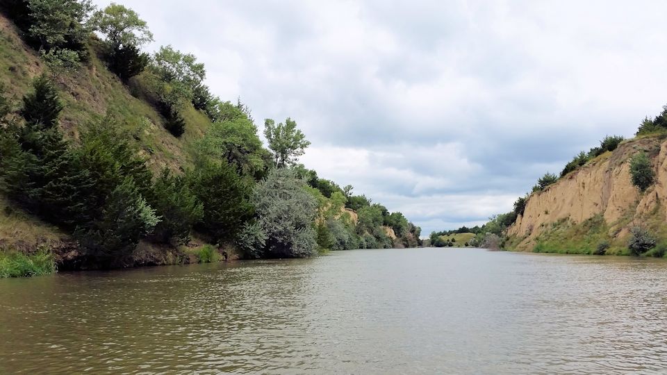
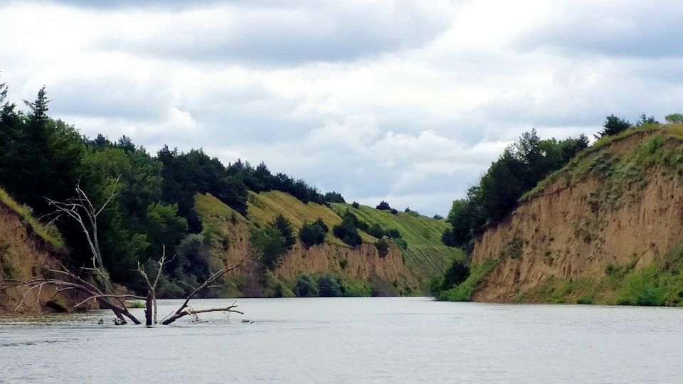
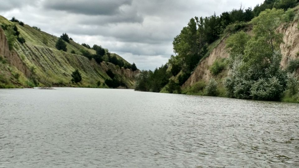
The zebra mussel has caused enormous problems in other parts of the country and has been detected in Nebraska in a lake at Offutt Air Force Base and on a dock on the South Dakota side of Lewis & Clark Lake.  Evidence of zebra mussels was also discovered on a boat and trailer at Harlan County Lake, although the specimens had died before the boat entered the water.  Whether it spreads to other lakes and rivers depends to a large degree on the public’s vigilance.  The mussels are one of many invasive species found in various lakes and rivers that can cause damage to boat motors and clog cooling water intakes at power plants.

quagga_mussels_3

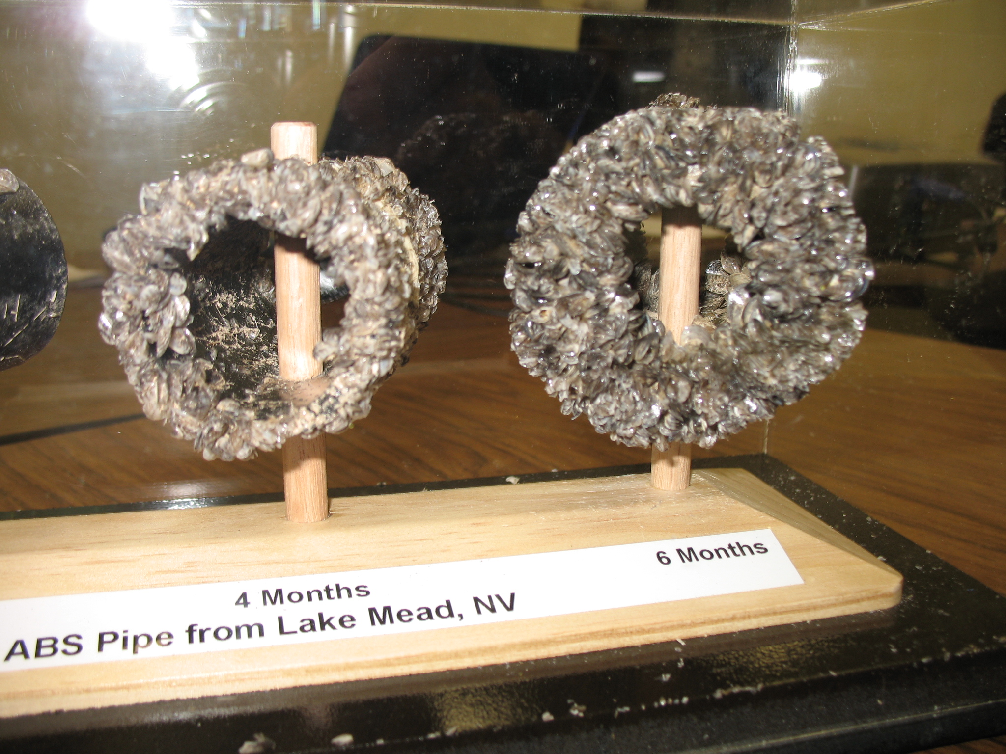
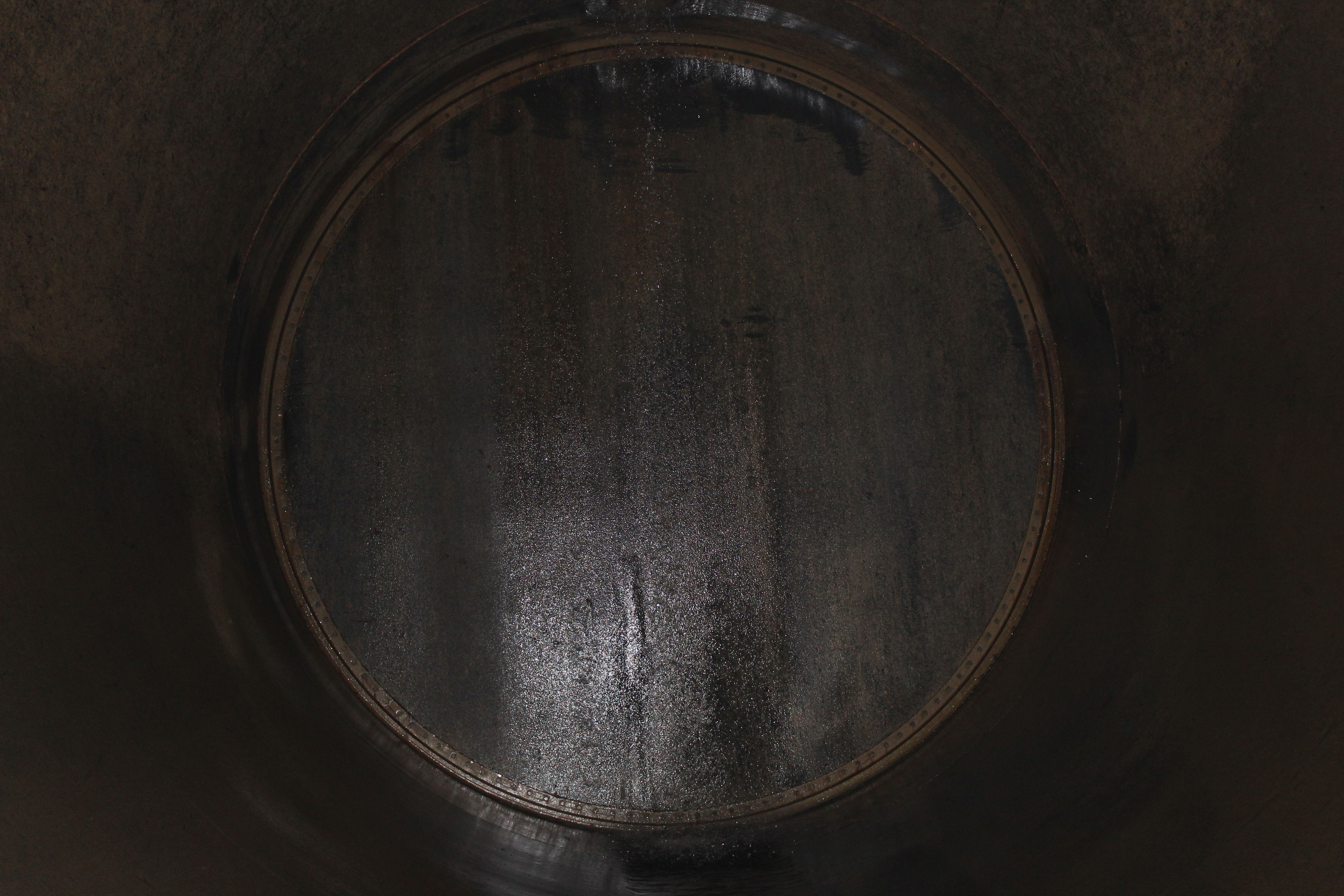
Pipes clogged by accumulation of quagga mussels.

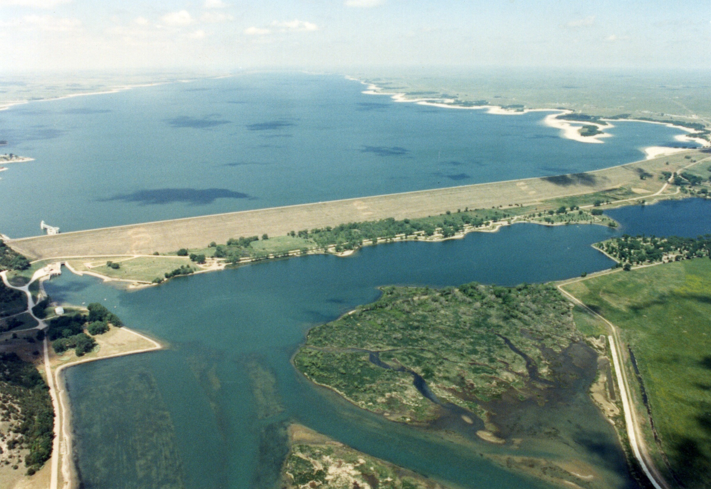
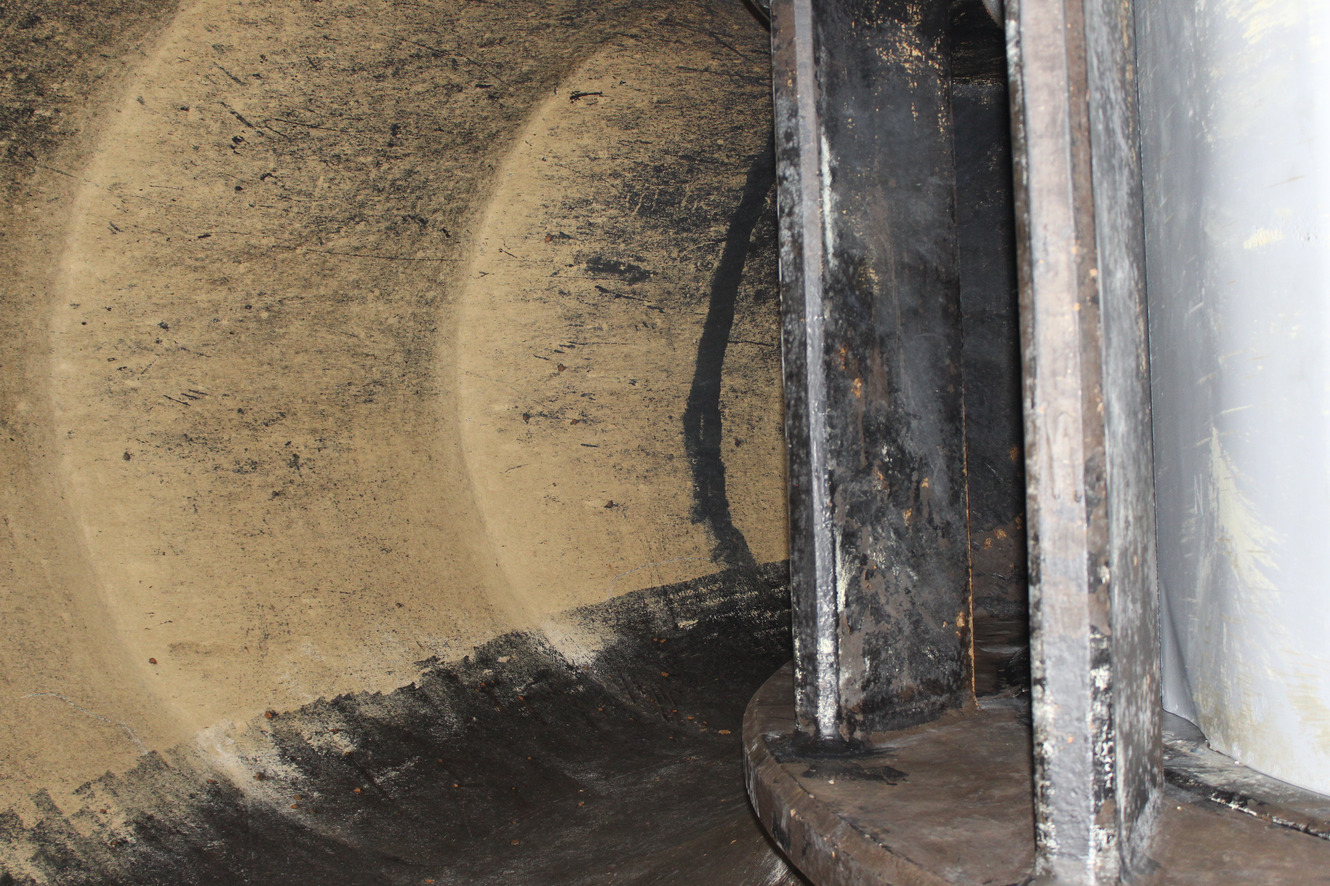
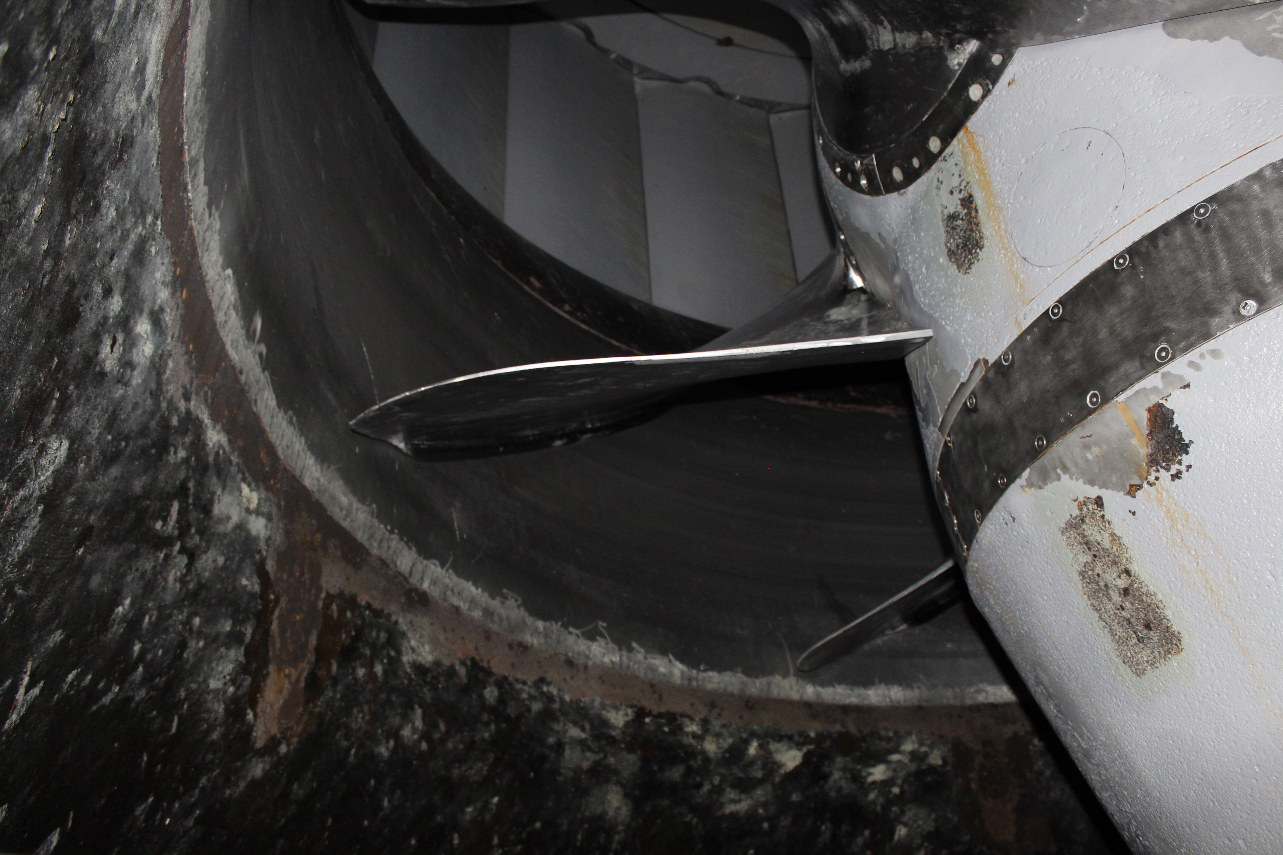
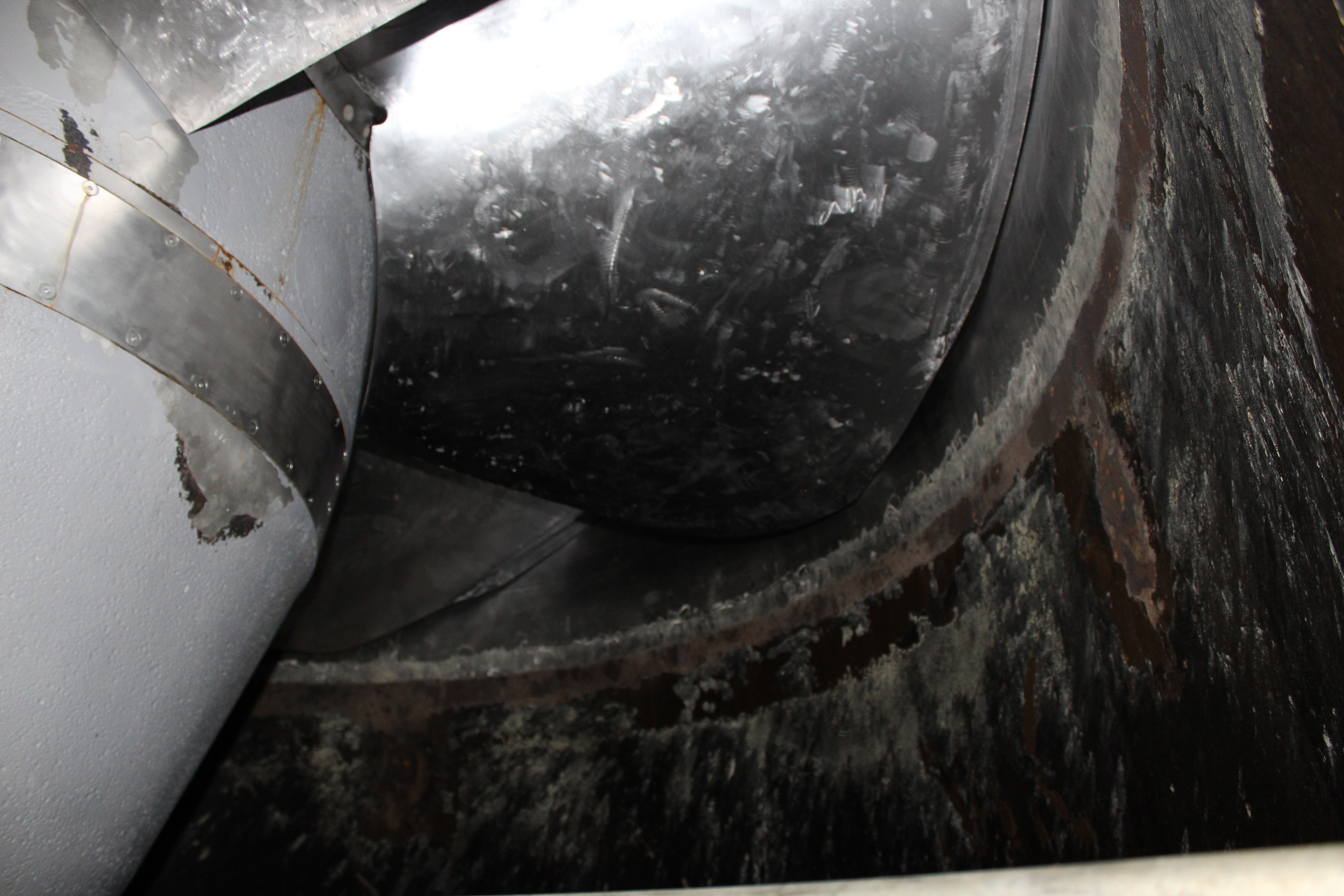
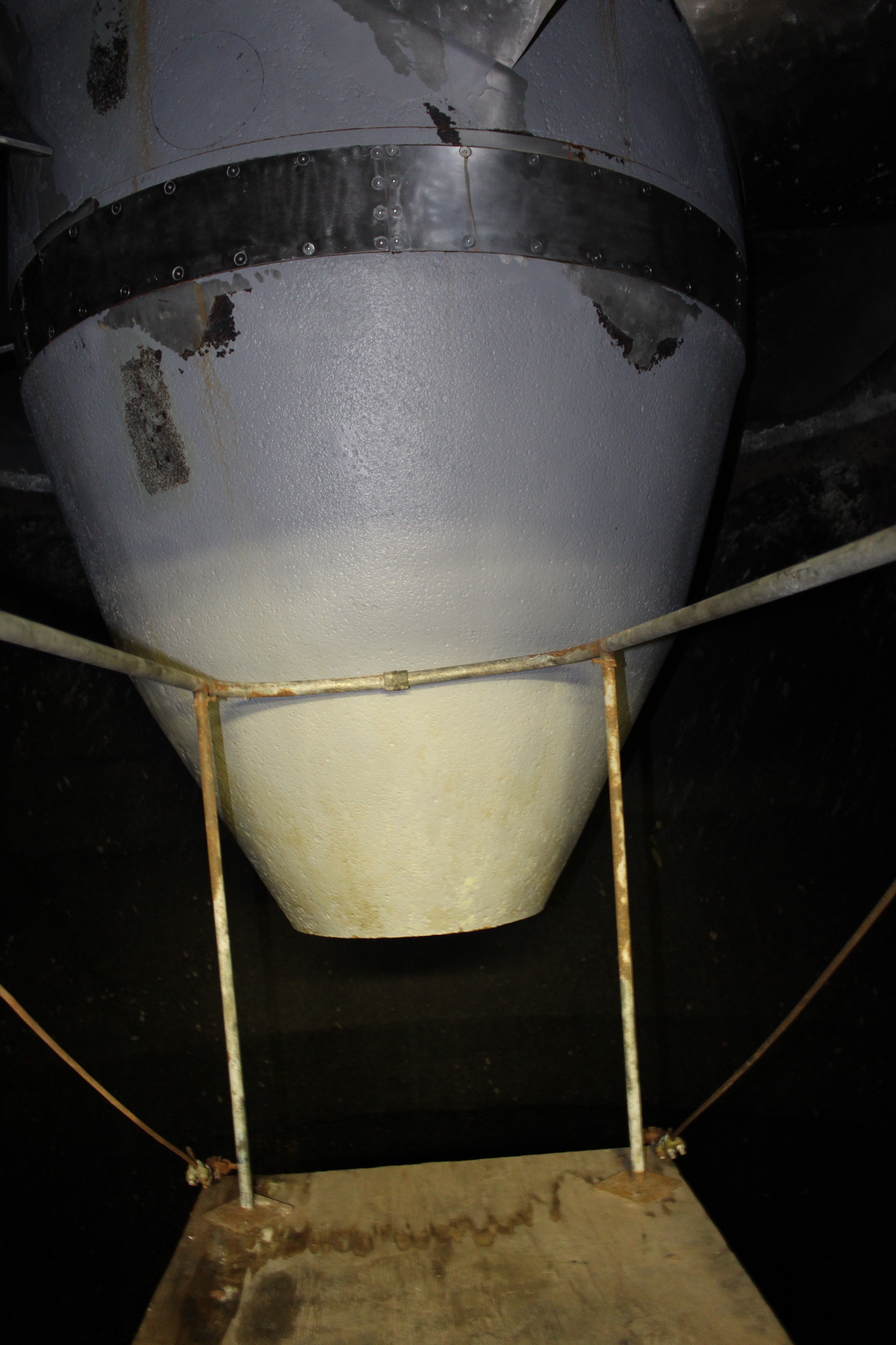
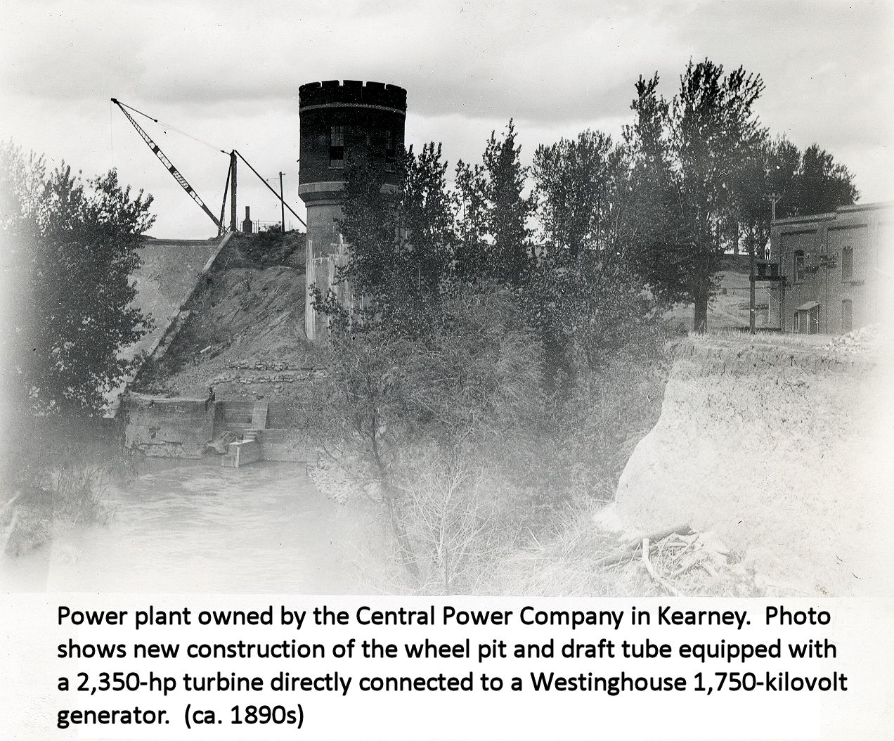
The Central Nebraska Public Power and Irrigation District uses water to generate electricity at the Kingsley Hydroplant at Lake McConaughy and also at three hydroplants along the Supply Canal between North Platte and Lexington.  In addition, the Nebraska Public Power District uses water from Lake McConaughy to cool equipment at Gerald Gentleman Station near Sutherland, and to produce power at the North Platte Hydroelectric Plant.  Preventing aquatic invasive species from fouling intake pipes and other equipment is important to continuing Nebraska’s ability to provide low cost, reliable electricity.

“We’ve seen the devastation that zebra mussels have done to water bodies in other states,” said Central Senior Biologist Mark Peyton.  “They dramatically change the fishery and natural balance of the lake or river.  What’s more, when they are in a system like the Platte River, it would be next to impossible to prevent them from infesting all the other water bodies associated with that system.

“Once a body of water is contaminated, monetary resources that could be used to improve and enhance recreational opportunities and wildlife value at the lakes are used instead to clean up and contain the mussels.  All in all, the mussels simply are not good for the system or for the people using the system.  We hope that people who use the lakes in Nebraska don’t become complacent about the threat because it’s out there, it’s real.”

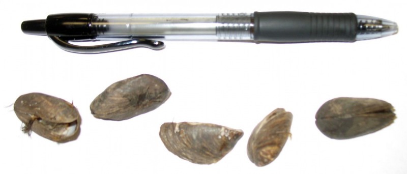
A freshwater mollusk native to eastern Europe and western Asia, the zebra mussel — so named for its striped shell — was first detected in North America in 1988 in Lake St. Clair, a small lake between Lake Huron and Lake Erie.  The first specimens probably arrived in the ballast water of ships that sailed from a freshwater port in Europe.  It has since spread throughout the Great lakes region and to river systems in the Midwest, including the Ohio, Illinois, Arkansas, and Mississippi rivers.

How can such a small mollusk create such problems?  First, they reproduce prolifically.  A single female, which has a life span of up to five years, can lay more than a million eggs during a single spawning season.  Second, the mussels anchor themselves to hard surfaces in huge numbers.

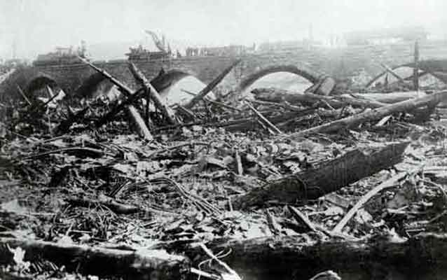
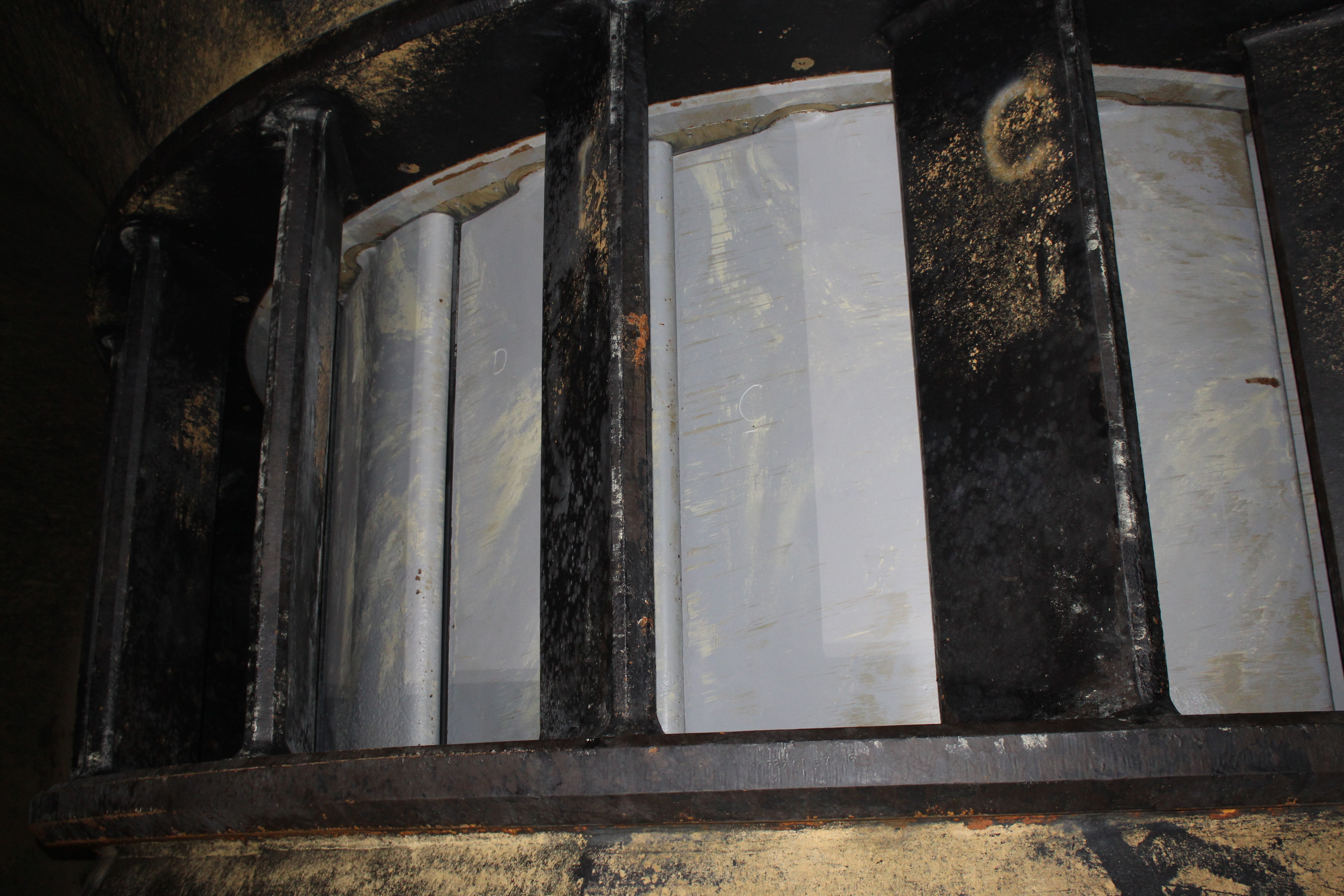
Water intake pipes at factories, water treatment plants, and power plants have been clogged by the buildup of mussels, requiring difficult and expensive removal.  Beyond industry, zebra mussels can infest boat hulls and motors, docks, lifts and any other structure in the water.  The shells of dead mussels can accumulate in great quantities on swimming beaches, the sharp edges posing a threat to swimmers’ feet.

In addition, because they feed by filtering algae and plankton from the water, they can disrupt the food chain at its base.

A relative of the zebra mussel, the quagga mussel, has been discovered at Julesburg Reservoir in the South Platte Basin, less than 50 miles from Lake McConaughy.  The quagga poses the same threat to industry and recreation as the zebra mussel and has been found in many western lakes.  Nationwide, the economic impact of the mussels comes to billions of dollars.

Karie Decker, formerly the coordinator for the Nebraska Invasive Species Project and now an assistant division administrator for the Nebraska Game and Parks Commission’s Wildlife Division, said, “Everyone who uses our lakes for any reason, be it recreation, irrigation, or power production, has a stake in preventing the spread of these species.  Quite literally, they can ruin a lake.”

She said there would be no way to eradicate the mussels if they gained a foothold in Lake McConaughy.

“We could only hope to contain them and even that would be expensive for Nebraska,” she said.

At the root of the state’s effort to educate the public about the threat posed by the mussels is the slogan, “CLEAN. DRAIN. DRY.”  Lake visitors are urged to clean, drain and dry any watercraft and recreational equipment before putting them into the water.

“Inadvertent human transport is the main pathway for introducing the mussels to other lakes,” Decker said.  “We want to make sure people aren’t transporting water that may contain larvae from one lake to another in boats, live wells, bait buckets, waders, or even vegetation attached to boat trailers.”

Decker said it doesn’t take long to inspect boats.  The more difficult task, she said, is simply making people aware of the need to do so and getting them to follow through with regular inspections.

The public is the only line of defense and Nebraska needs help to repel the invader.  For more information about the invasive mussels, visit the Nebraska Invasive Species Project’s web site at http://snr.unl.edu/invasives.


1 2 3 4 5 6
Facebook
Twitter
LinkedIn
Instagram