Blog

Summer Tech Will Treasure Experience for a Lifetime

Summer Tech Will Treasure Experience for a Lifetime

The experience of working at Lake McConaughy is something I’ll hold onto for the rest of my life.

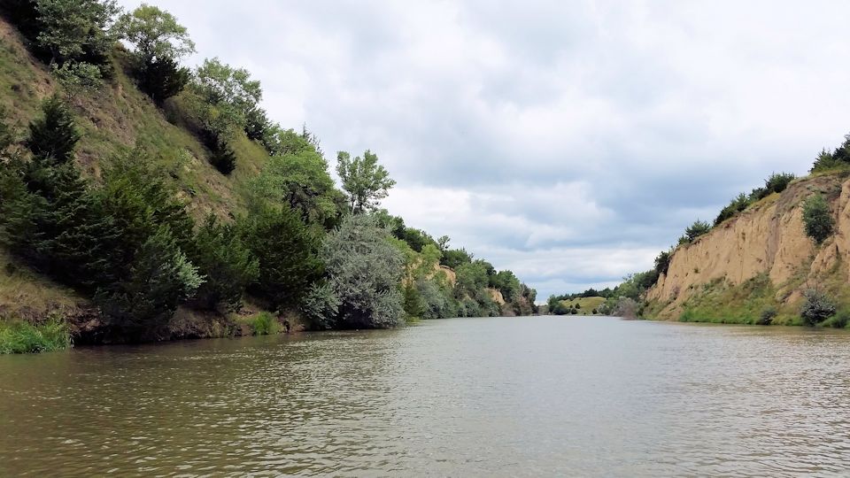
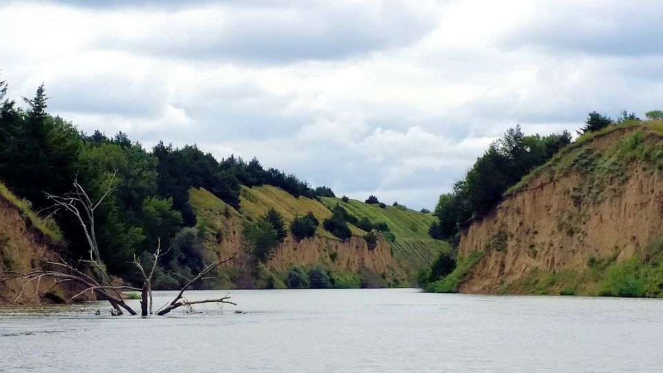
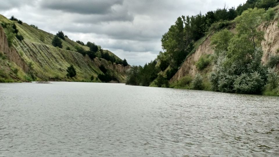
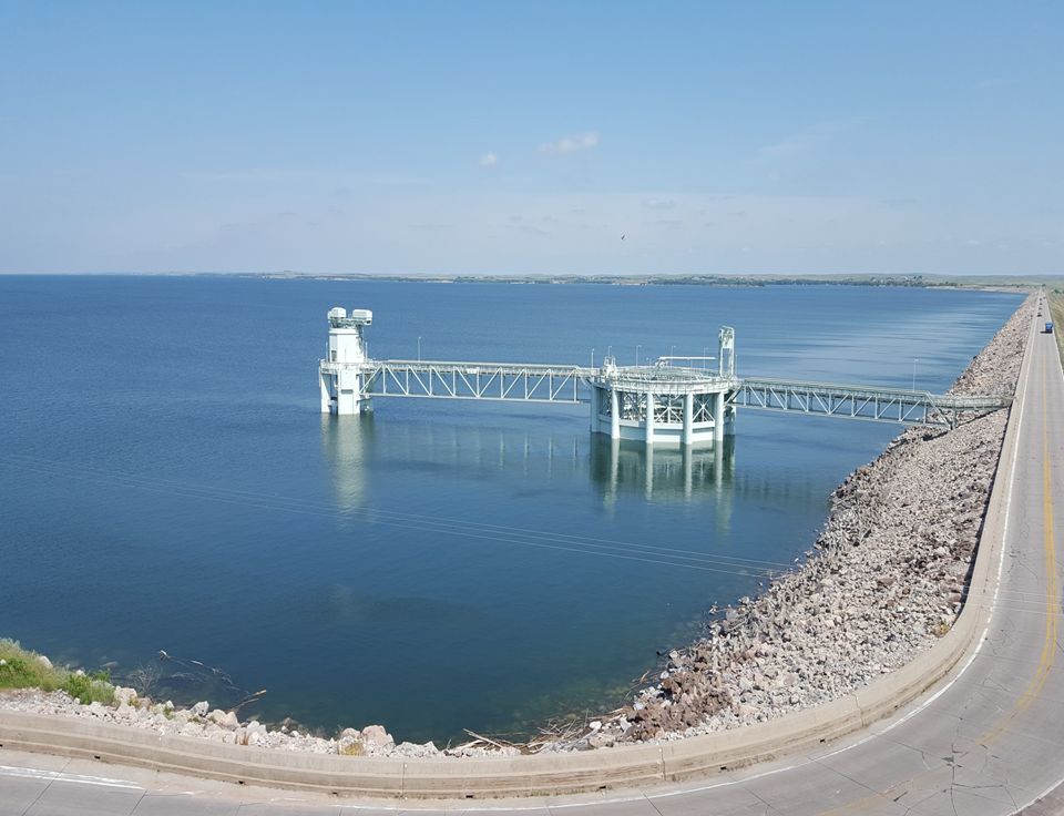
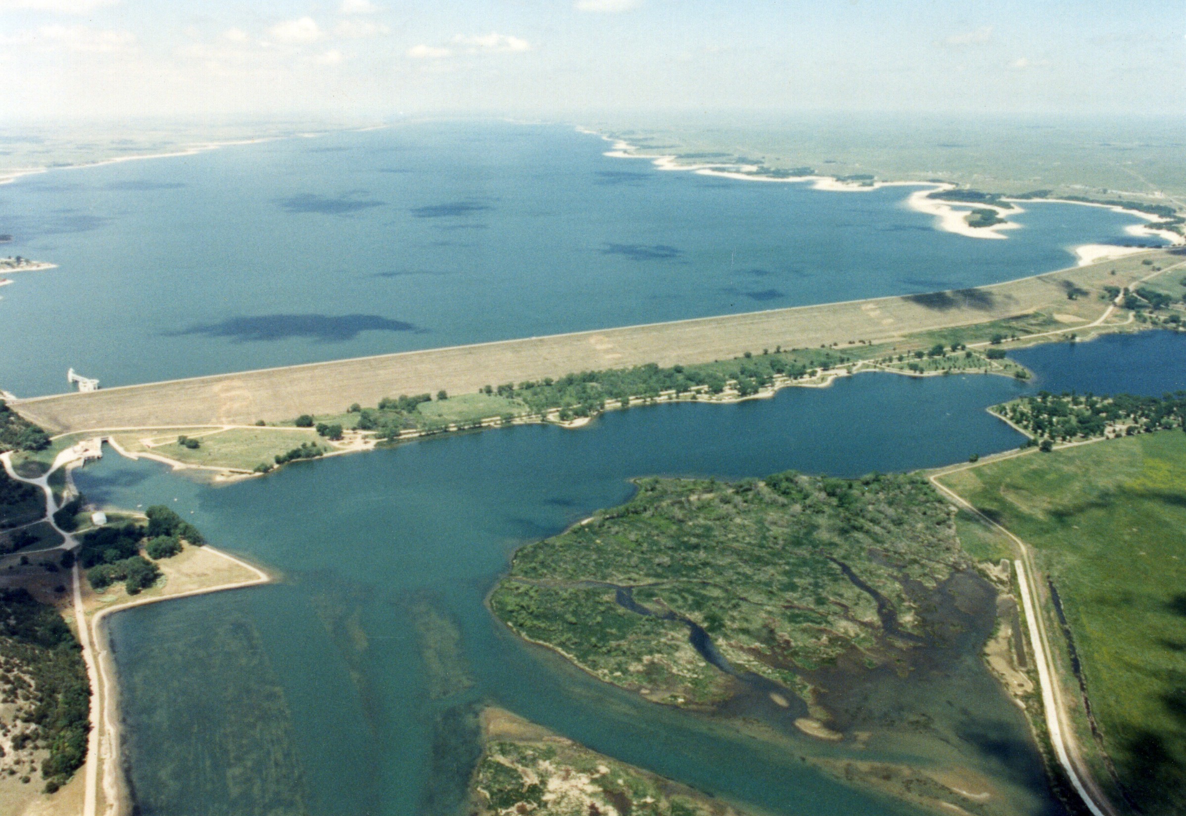
I spent a second summer at Lake McConaughy working as a biological technician for The Central Nebraska Public Power and Irrigation District. The gorgeous landscape that surrounds the huge lake is remarkable and the white sandy beaches make the lake unlike any other I’ve seen. The sandy shorelines make an excellent destination for campers and outdoor enthusiasts from all over, but people are not the only ones utilizing the beaches.

Piping plovers and least terns are small shorebirds that also call Lake McConaughy home during the summer months. These magnificent birds are ground nesters and the fine sandy beaches of Lake Mac make the perfect habitat in which to hide their eggs. But because the birds share their nesting sites with people who are enjoying the lake, their nests are in danger of accidental destruction from getting run over, stepped on, or destroyed by unleashed pets. This is where my job becomes important.

Plover eggs in a nest, a small scrape in the sand, exhibit the camouflage that provides protection. Photo by Dillon Schroeder.

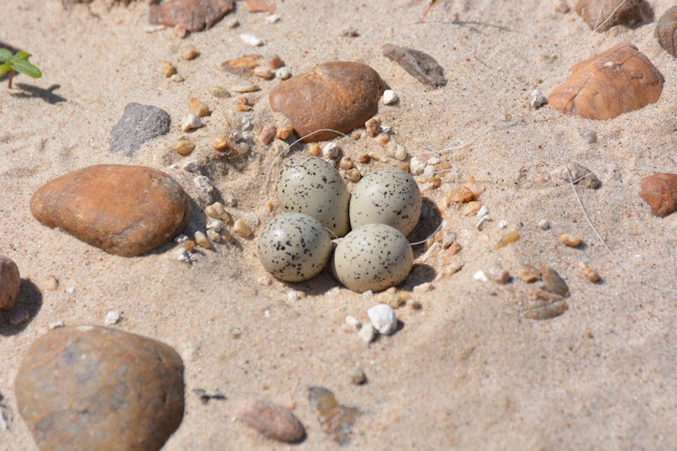
During the early months of the summer – late May and June — a typical day for me would be to survey the beach, searching for plover and tern nests and eggs, which is more difficult than one might imagine. The eggs are slightly smaller than a quarter and blend into the sand extremely well, which is the reason they nest in open, sandy places.

Once a nest is located, certain actions must take place to ensure that it has the greatest possible chance of producing eggs and chicks. In areas where human traffic is heavy, an enclosure is constructed around the nest, consisting of orange flagging and signs to make it as visible as possible to beach-goers. The enclosures are large enough that the bird will feel comfortable sitting on the nest as people drive or walk by. In certain areas around the lake where nests are more frequently established, a much larger enclosure is built. These enclosures could have more than ten nests inside them, and make it possible for the birds and chicks to go all summer without human interaction. As the summer progresses, the eggs begin to hatch and then comes the difficult task of keeping track of all the chicks on the beach until they are old enough to take flight. This can be difficult as the chicks can roam a great distance in either direction in a single day. However, this summer was much different than last.

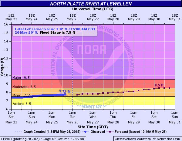
Early in the summer, we had many much needed rain showers, causing flows in the North Platte River to rise dramatically. This meant a high volume of water flowing into the lake, which raised its elevation by more than a foot a week. The beaches rapidly disappeared as the birds were trying to find a suitable spot to make a nest. Just as the birds would find a site, the location would become inundated by the rising lake. As days passed, more and more birds left the lake in search of different locations to nest. By the end of the July, which is the natural deadline for these birds to make a new nest, we had no successful nests as the lake rose to 97 percent of its capacity. All suitable habitats were covered by water and the birds were forced to leave without having a successful nesting year at the lake. However, these birds tend to be resilient and will surely be back next year to give it another go!

This summer at the lake was one of the most interesting experiences I have had. Watching how the birds reacted to the water rising and seeing them battle each other for territory on what little beach remained was a sight unlike any other. This summer also showed me just how much natural changes can affect the entire ecosystem of the lake. Not only were the birds forced to leave without successfully nesting, but people had to find other areas to park their campers or pitch their tents , which was quite a sight to see. The fishing at Lake Mac quickly became more challenging as the summer went on. As the lake expanded, so did the areas in which fish could forage or take cover. Watching how fisherman reacted and tried new tactics was also interesting to me, as I am an avid fisherman.

All in all, one of the most important lessons I learned this summer is that things don’t always go as planned, but you have to be ready for whatever happens and learn to adapt to the situation that you encounter. I am thankful I am able to come away from this experience with such an important life lesson!

— Tony Jenniges is a senior at the University of Nebraska-Kearney, majoring in wildlife management with plans to enter a master’s program in the same field. He has worked two summers for Central, as well as a summer internship with the Nebraska Game and Parks Commission. He also has worked for Headwaters, Inc., on tern and plover monitoring at sandpits in the central Platte River area as part of the Platte River Recovery Implementation Program monitoring efforts. In addition, he has participated in whooping crane monitoring by airplane, also a part of the PRRIP monitoring program.

The Supply Canal: Scenic Canoe Trips Await

The Supply Canal: Scenic Canoe Trips Await

Can you identify the locations of these photos?

Supply_Canal_Photo_1(a)Supply_Canal_Photo_3a

SUPPLY_CANAL_PHOTO_5a

No, they weren’t taken along a wild and scenic river, or at some national park. These photos were taken along Central’s Supply Canal, which runs from just east of North Platte to east of Lexington. Many sections of the canal wind through high banks, and narrow canyons.

The public is permitted to use the entire length of the canal for recreational purposes, excluding areas around Central’s three hydroelectric plants and NPPD’s Canaday Steam Plant. Portages around check structures are relatively easy, but getting around the hydroplants requires a lengthier overland trek. Launching a canoe or kayak may be difficult in some spots because of the shoreline protection materials (in most cases, broken concrete riprap). Many sections of the canal are paralleled by maintenance roads or state and county roads. The flow in the canal is relatively constant year-round, the water is 15 to 20 feet deep in most places, and the current is not rapid (no whitewater stretches), although caution should be exercised when approaching check gates.

The 75-mile-long Supply Canal and its many canyon lakes are used for hunting, hiking, canoeing and kayaking, camping and fishing. Only wakeless boating is allowed on the canal to prevent bank erosion.

Also, when planning a canoe or kayak trip, it’s a good idea to remember these helpful hints from the Nebraska Game and Parks Commission:

  • Wear your life jacket.
  • Take a spare paddle.
  • Don’t canoe alone.
  • Have tether ropes on both ends of the canoe.
  • Take insect repellant.
  • Take ample water.
  • Take sunscreen, sunglasses, and wide-brim hat. The sun’s reflection off the water can be intense. If it is hot, start early or later in the day and make the trip shorter.
  • Put extra clothing, gear, and food in water-proof bags.
  • Take rain gear, but not ponchos.
  • Take first aid kit. Learn what poison ivy and poison oak look like, as well as black widow and brown recluse spiders.
  • Avoid contact with livestock and wild animals.
  • Protect your feet with tightfitting wading shoes.
  • Camp only in designated areas. Obtain permission prior to camping on, or entering the water from, private land.
  • Read maps and plan ahead. Be off the water before dark.
  • TRASH: If you create it, e.g., cans, bottles, food wrappers, etc., pack it out. Don’t discard it in the water.
  • Build fires only in fire rings; drown flames and coals after use. If no fire ring exists, use only camp stoves.
  • Use caution when loading and unloading near highway or county bridges.
  • And remember, Nebraska’s weather can be unpredictable and prone to extremes of temperature, humidity, wind and rate of change. Summer storms rapidly form, are fast-moving and can have rain, hail, high winds, lightning, and tornados combined.  Pay attention to signs of bad weather, get off the water and take cover as quickly as possible if a storm is approaching.

Central Hosts Water for Food Institute Researchers

Central Hosts Water for Food Institute Researchers

A group from the Robert B. Daugherty Water for Food Institute (DWFI) visited sites within Central’s irrigation service area on Aug. 18 as part of a workshop aimed at “Understanding the Water-Energy-Food Nexus for Irrigated Agriculture.”

After a catered lunch at Central’s headquarters in Holdrege, the group stopped at a subsurface drip irrigation site near Loomis. The SDI system was installed several years ago as a demonstration project to investigate the use of water delivered from Central’s canal system through buried drip tape on an 8-acre pivot corner. Over the years, crop yields from the acres irrigated by the SDI system have regularly matched or exceeded yields obtained from acres irrigated under the adjacent pivot, while the volume of water has been significantly less than applied by the pivot.

The next stop was at a soybean field where the producer installed a drop-span pivot to enable irrigation of approximately 23 acres that could not be covered by a normal pivot because of obstructions. The system can use either surface water from Central’s canal, or groundwater from a well, although the well has been used sparingly recently. The pivot uses GPS control to automatically stop at the desired point to allow the producer to either disconnect or connect (depending upon which way the pivot is traveling) the drop spans to continue its path through the field.

Central Valley Irrigation representatives from Holdrege, including owner Monte Vonasek and employees Project Manager Jeremiah Johnson and Coordinator Design Manager David Hoferer, were on hand to fully explain the design challenges that had to be overcome to make the system perform the way the producer envisioned. The process of manually connecting or disconnecting the spans can be accomplished in about 15 minutes. By all accounts, the pivot has exceeded expectations and solved what was formerly a perplexing irrigation problem.

The group also visited another pivot-irrigated field – also with the capability of using either canal water or well water – near Johnson Lake. Central Valley Irrigation also provided the equipment and ingenuity to irrigate acres that previously were beyond the reach of a normal pivot. The answer in this instance was a double swing-arm pivot that bends in and out to cover hard-to-reach areas of the field.

Next, the group stopped at one of the sites along the E67 Canal system that has been equipped with telemetry equipment. Equipment was installed this spring to enable collection of data that will facilitate precision irrigation management to conserve water.

UHF radios, digitized flowmeters, rain gauges and solar panels have been installed at 26 sites (approximately 42 more turnouts will be equipped over the next two years). Real-time or near real-time data from those sites, along with data compiled at two automated weather stations in the E67 area, will be available to producers online to use with field evapotranspiration (ET) and water balances data to optimize water management and irrigation efficiency. Field data and graphs can be accessed on any device with an internet connection.

Partners in the E67 telemetry project include Central, McCrometer, the Nebraska Environmental Trust Fund, and University of Nebraska Cooperative Extension.

The group concluded the tour by visiting Central’s nearby Johnson No. 1 Hydroplant just below Johnson Lake. For many tour participants, it was the first opportunity to visit a hydroelectric facility, which was generating at nearly full capacity during the visit.

Participants from DWFI included: Nicholas Brozovic, director of policy; Isidro Campos Rodriguez, post-doctoral research associate; Timothy Foster, post-doctoral research associate; Rachel Herpel, research and outreach coordinator; Jasmine Mausbach, DWFI intern; Christopher Neale, director of research; Paul Noel, program associate; Patricia Song, DWFI intern; and Richael Young, program associate.

Other workshop attendees who were on the tour included: Rosemary Carroll, assistant research professor in hydrologic sciences at the Desert Research Institute in Reno, Nev.; Yusuke Kuwayama, Resources for the Future fellow, Washington, DC; Taro Mieno, assistant professor at the University of Nebraska-Lincoln; Mani Rouhi Rad, Ph.D. student at the University of Illinois at Urbana-Champaign; and Cameron Speir, an economist with the National Oceanic and Atmospheric Administration’s Southwest Fisheries Science Center in Santa Cruz, Calif.

Central extends special thanks to the gentlemen from Central Valley Irrigation for sharing their time and expertise; to Rachel Herpel for bringing the group to south-central Nebraska; to McCrometer’s Paul Tipling for helping to explain the telemetry project; and to producers Scott Ford, John Ford, and Willie Knoerzer (a member of Central’s board of directors) for taking the time to explain their innovative pivot operations to the group.

The DWFI group at J-1 Hydroplant.

The DWFI group at J-1 Hydroplant.

From the Archives: Electronic Equipment Will Monitor Supply Canal

From the Archives: Electronic Equipment Will Monitor Supply Canal

The following article, republished from the August, 1964 edition of The Central Nebraska Irrigator, Central’s newsletter, tells about a rudimentary alarm system along Central’s Supply Canal, which was the precursor of today’s Supervisory Control and Data Acquisition (SCADA) system that monitors and controls water conveyance and hydroelectric generation throughout Central’s hydro-irrigation project.

The article was, in a way, clairvoyant. The writer may or may not have had some foreknowledge of what was to happen in the near future, but it also demonstrated that even in 1964, Central was ahead of its time.

Eight years after the article was written, the Gothenburg Control Center went into operation (in January, 1972) when remote supervisory control was established over the Diversion Dam, the Supply Canal’s hydroplants and control structures and the head gates of the irrigation canals. All are now monitored on computers at the Control Center by a supervisory control operator.

Control of Kingsley Hydro, NPPD’s Keystone Dam and the head gates of NPPD’s supply canal at the east end of Lake Ogallala were later added to the Control Center’s responsibilities because of the need for close coordination between the three components of the system to ensure proper flows into the canal and down river.

Communication is the key to such an automated system. The District has its own microwave system, supplemented by buried cable and VHF radio links. All information gathered at the remote terminal units (RTUs) is fed into the Control Center’s computers.

There are more than 1,800 alarm, control or telemetering points on the system which monitor and/or control functions of canal structures, pump stations, the three Supply Canal hydros and Kingsley Hydro.

The Control Center computer is programmed to receive data from the RTUs, check for alarm conditions and alert the operator to any abnormal readings. The operator’s control console includes a video screen that shows the current condition at any selected location on the system. Control functions are accomplished on a keyboard. The control room is manned around the clock every day of the year.

The automation enables Central to: 1) increase the generation of hydropower; 2) better manage the system under high-water conditions, i.e., sudden, heavy rain storms; 3) reduce the incidence of spills; 4) reduce maintenance needs on the canals as a result of better control of flows; and 5) reduce operating costs.

 From The Central Nebraska Irrigator, July/August, 1964

Electronic Equipment Will Provide Constant Check of Central’s 75-Mile Long Supply Canal

Gothenburg Division personnel in charge of operating Central’s 75.6-mile-long Supply Canal are sleeping a little better these days as an alarm system has been installed that will automatically notify the operator on duty at Jeffrey Hydroplant of a high- or low-water situation at any of four locations along the canal.

(Editor’s note:  The featured image on the blog page shows the transmission equipment located adjacent to water level detection equipment on the Supply Canal.)

Designed by Central’s Assistant Chief Engineer Ed Hamilton, the equipment was installed by the District’s electrical crew and members of the Gothenburg Division. The alarm systems have been installed at mile posts 5.1, 11.9, 31.2 and 35.9. These locations were considered as strategic or the most critical along the lengthy canal route.

Dale Craig, Jeffrey Plant operator, checks receiver equipment linked by radio to transmission equipment along the Supply Canal.

Dale Craig, Jeffrey Plant operator, checks receiver equipment linked by radio to transmission equipment along the Supply Canal.

A water control gate is located at each of the four points and the alarms will tell the Jeffrey operator if water is high or low behind the gate or high or low below the gate.

The Jeffrey operator will also receive a visual and audio alarm should the power fail at any of the four locations.

The alarm equipment at the four canal sites includes electrodes and relays that are located in corrugated metal pipe wells upstream and downstream from the structure gates. These detect the high or low water levels. This equipment is connected to a radio transmitter with a tone encoder and timer that are mounted with a battery and battery charger as a power source.

When a high or low water level, or power failure occurs, the tone code is transmitted to the Jeffrey Power House by the radio transmitter and this code then switches on the proper light on a small panel at the power operator’s desk that indicates the location and type of trouble. A horn sounds at the same time.

The plant operator, hearing the horn, then checks the panel and determines by the light the location and type of trouble. He then silences the horn and contacts a canal patrolman or supervisor by phone and reports the trouble.

The four installations are the initial ones for the Supply Canal and it is expected that eight more locations will be included in the future.

A third phase in Central’s efforts to gain tight control of the Supply Canal will be automatic water recording equipment located at several points along the canal.

This equipment, by tone transmissions over the District’s Supply Canal telephone line, will give hourly readings of the canal water levels and gate openings.

The hydro plant operators will also be able to question this equipment at any time between the hourly readings.

When installed, the plant operator, after receiving a signal of high or low water conditions at any point on the canal, could then question the water recording equipment and find out exactly how high or low the water is. By questioning the water recorder at short intervals he could then determine if the trouble was of a temporary, self-correcting nature or if it is necessary to report the condition to a canal patrolman or his supervisor.

The information supplied by the alarm and recording equipment will give the Central District 24-hour coverage of its Supply Canal with instantaneous indications of canal trouble such as flooding from heavy rains, leaks or malfunctioning gates.

As the District gains more experience in the installation and operation of such electronic equipment, it is anticipated that similar systems will be worked into the hundreds of miles of irrigation canals owned and operated by the District.

Central donates floating pumps to Johnson Lake area fire departments

Central donates floating pumps to Johnson Lake area fire departments

The Central Nebraska Public Power and Irrigation District donated four portable water pumps this summer to fire departments in the Johnson Lake area.

The floating pumps will enable the volunteer fire departments – from Lexington, Elwood, Cozad and Eustis – to access water directly from lakes or canals in the vicinity of fires to supplement water available from tanker trucks.

The four pumps cost a total of about $13,000 and, according to Central Public Relations Advisor Tim Anderson, are kind of like insurance.

“We hope they never have to be used,” he said, “but they’ll be a nice addition to the fire fighters’ equipment in the event of a fire at the lake or another remote area where access to water is limited.”

The donation of the pumps came in the wake of a multiple-structure fire at Johnson Lake in 2013. One cabin was completely destroyed and two other cabins sustained extensive damage.

Anderson said the after-action report indicated that responding fire departments encountered difficulties with obtaining enough water to fight the fires.

He added that the pumps can be deployed quickly and, given the mutual aid agreement between the four fire departments, all four pumps could be used at the same time if necessary. Each pump can deliver about 300 gallons per minute.

“We thought – and the board of directors agreed — it was a good use of the lake improvement fund,” Anderson said, referring to money budgeted each year for improvements at Johnson Lake.

NRCS Boss, Employees Tour Project

NRCS Boss, Employees Tour Project

Employees of the U.S. Department of Agriculture’s Natural Resources Conservation Service (NRCS) toured Central’s hydro-irrigation project on July 14. Tour participants included Nebraska NRCS State Conservationist Craig Derickson of Lincoln and representatives from NRCS offices in Grand Island, Spencer, York, Lexington, Elwood and Minden.

Participants in the NRCS tour, including State Conservationist Craig Derickson (at left) listen to an explanation of how data from an automated weather station is used in the E67 irrigation management/telemetry project.

Participants in the NRCS tour, including State Conservationist Craig Derickson (at left) listen to an explanation of how data from an automated weather station is used in the E67 irrigation management/telemetry project.

The participants assembled at Central’s office in Holdrege, then headed to several sites within the District’s irrigated area, including stops showing pivot and sub-surface drip irrigation installations on Central’s system, and automated check gate structures along the main canals. One of the highlights in the morning was a stop at a site within the E-67 Canal area where Central’s Conservation Director Marcia Trompke explained the workings of the new telemetry project.

The telemetry project began this spring with the installation of radios, remote terminal units (mini-computers that relay data), and weather stations to serve one-third of the turnouts on the E-67 system. Over the next two years, the remaining turnouts will be similarly equipped.

This project’s objective is to gather irrigation water use and environmental data to support Central’s irrigation water management, water conservation and water quality goals. The project involves the cooperation of Central’s customers irrigating about 5,800 acres in the E67 area north of Elwood and Smithfield.

The project will collect irrigation water use data from irrigation flow meters and weather monitoring sensors crucial to irrigation management. Data will be available in real time to Central and individual irrigators through digital applications to help customers make sound irrigation management decisions.

The project is partially funded by a grant from the Nebraska Environmental Trust Fund and includes partnerships with UNL Extension for educational services and the McCrometer Co., which is providing flow meters, technical expertise and equipment installation training.

The tour continued on to the Gothenburg Control Center where Electrical Superintendent Devin Brundage explained Central’s highly automated system for monitoring and controlling water all the way through its hydro-irrigation project.

After lunch at Gothenburg’s Nebraska Barn & Grill restaurant, courtesy of Central, the group then headed to the Lake McConaughy Water Interpretive Center where the participants viewed a video about the construction of Kingsley Dam and then toured the reservoir’s control structures. Kingsley Dam Foreman Nate Nielsen then explained the workings of the Kingsley Hydroplant, which was generating 30 megawatts of clean, renewable hydroelectric power at the time.

According to Nate Garrett, P.E., NRCS area engineer in Grand Island, who arranged the tour, “It was an opportunity for us to see one of Nebraska’s premier ag-engineering accomplishments and to network with one of our irrigation partners in the central part of the state. It was a fantastic tour.”

Tessa Combs, an NRCS intern who hails from Kentucky and who is working in Grand Island this summer, said, “It was really helpful to actually see the facilities and how they operate, instead of just reading about it or trying to figure out the complexities of the project by looking at a map.”

Central routinely offers tours of its hydro-irrigation project to organizations and groups throughout Nebraska, as well as groups from other states and foreign countries. If your group is interested in a one- or two-day tour of the sprawling project, contact Public Relations Coordinator Jeff Buettner at (308) 995-8601. We’ll set a date for you!

June Inflows Boost Lake McConaughy

June Inflows Boost Lake McConaughy

When June came to a close, inflows to Lake McConaughy during the month had entered the records books as the fifth highest since storage began at the reservoir in 1941.

Inflows totaled 335,138 acre-feet (a-f) for the month. The five highest inflow totals for June:

YearInflow (acre-feet)
1984505,376
2011471,436
1973439,643
1983438,691
2015335,138

Wet Junes are not unprecedented, nor particularly unusual. Historically, peak inflows typically occur in October – following the end of irrigation season – and June, often because of spring precipitation and snowmelt runoff.

However, this June’s inflows were more than four times the historical median of 74,924 a-f and were somewhat unexpected. Inflows to Lake McConaughy in March were only 85 percent of the historical median of 75,959 a-f, and April’s inflows were 82 percent of “normal.” Projections, upstream storage conditions, and weather patterns did not indicate the likelihood of much of an uptick in inflows, but frequent and sometimes heavy precipitation in May altered the trend. Inflows during May surged to 163,429 a-f, almost two-and-a-half times more than the historical median, and well-above average inflows continued throughout the month of June.

Lake_McConaughy_July1-2015(a)

Lake McConaughy at elevation 3263.3 feet on July 1, 2015

The much needed inflows raised Lake McConaughy’s storage level to elevation 3,263.1 feet on June 30, less than two feet from the maximum operating level that was established in 1974. The maximum level was put in place after high winds during a 1972 storm caused significant wave damage to the face of Kingsley Dam. The storm occurred when the reservoir’s elevation was above 3,266 feet; maximum designed elevation at the time was 3,270 feet.

Just in case, Central recently sought and received a waiver from the Federal Energy Regulatory Commission to exceed the 3,265.0 elevation by up to two feet if necessary to hold back North Platte River water and prevent it from contributing to flooding conditions in stretches of the central Platte River being caused by high flows in the South Platte River.

July arrived with the typical hot, dry conditions (although it was raining again as this post was being written), and flows in both the North Platte and South Platte rivers are beginning to recede. Irrigation demand is also picking up slightly, although growers will monitor soil moisture conditions before irrigating. Abundant soil moisture often inhibit good root development, simply because crops’ roots don’t have to go far to find water.

As the rivers and inflows begin to recede, it now appears unlikely that Central will need to exceed its normal maximum elevation. What does appear likely is that Lake McConaughy will be in excellent shape in terms of next year’s water supply.

Central Conducts Exercise of Emergency Action Plan

Central Conducts Exercise of Emergency Action Plan

We’ve all heard the phrase that starts out, “In the unlikely event of … (insert here your favorite disaster).”

When it comes to a failure of Kingsley Dam, one can probably CAPITALIZE, boldface and underline the “unlikely” part of the phrase, but nevertheless, The Central Nebraska Public Power and Irrigation District is prepared. It HAS to be. Kingsley Dam impounds the largest body of water in Nebraska and its failure would be catastrophic by any measure, but if the dam failed when Lake McConaughy was full, the resulting flood would affect the Platte River Valley all the way to the Missouri River.

To be clear, the chance of a dam failure is at the lower end of the “slim to none” scale, but because of the volume of water involved and the potential consequences downstream, nothing is left to chance.

In Gothenburg Division Manager Kevin Boyd’s words, “Kingsley Dam is safe, it’s big, it’s sturdy and there are a lot of redundancies built into our ability to evacuate water rapidly to avoid overtopping or breaching the dam. Plus, there are a lot of eyes on the dam; it is constantly monitored and frequently inspected.”

But Central is prepared for the “what if’s.” As Nebraskans in many of the state’s river basins have seen all too frequently in recent years, floods caused by excessive snowmelt runoff, precipitation events or a combination of factors are a fact of life.

As part of that preparation, Central conducts a functional exercise of its Emergency Action Plan (EAP) for Kingsley Dam every five years. The object of the exercise is to coordinate with each local, county, state and federal agency on responses to such an emergency. In addition to refreshing each agency’s familiarity with their response plans, it also provides an opportunity for the agencies to provide input about how the response plans might be improved or updated.

Kingsley Dam functional exercise 6-10-15 -7 (2)

Central civil engineer Tyler Thulin, acting as a facilitator for the EAP, delivers a message to a member of the Nebraska State Patrol who was participating in the functional exercise.

During Central’s recent functional exercise, representatives from about 13 different agencies first went through a “table top” exercise where each agency outlined their planned responses in the event of an emergency. The scenario was then set for the functional exercise, which involved extremely high inflows into an already full reservoir, capped by several successive days of strong winds pushing high waves onto the dam. To provide a little realism, Central enlisted the assistance of KNOP-TV in North Platte to produce short videos containing simulated emergency broadcasts using their own on-camera reporters relaying details about the dam failure. The “broadcasts” were shown to the participants to set the stage for the functional exercise.

Participants were then dispersed throughout Central’s office in Gothenburg and the functional exercise was initiated, with messages among and between agencies flowing back and forth across the office phone system. “Facilitators” (Central employees) also helped the flow of information and communication by relaying “emergency messages” that required a response by a particular agency. For example, a message from a member of the public was given to the Nebraska State Patrol that reported a trapped motorist on a flooded road below the dam. The patrolmen on site then had to decide how they would respond given the limited ability to travel below the dam and the constraints upon available manpower.

The functional exercise simulates a dam failure or high-flow event in a stress-induced environment subject to time constraints on responses. It’s as close to reality as can be without actually mobilizing manpower and equipment. The exercise’s objectives include a determination of assets available from the various agencies, a test of how closely anticipated responses match reality, analysis of how the EAP can be improved, and providing an opportunity to improve cooperation among agencies.

In a high-inflow scenario that raises Lake McConaughy’s level to or near capacity, Central would follow an escalating set of conditions, starting with a “non-failure emergency” condition. If the situation is not resolved, Central would then enact the part of the EAP that alerts agencies about a “potentially hazardous situation developing.”

“One of the best options to save the dam that Central has is to increase releases through the “Morning Glory” spillway,” said Scott Airato, a senior civil engineer responsible for dam safety at the Federal Energy Regulatory Commission’s Chicago Regional Office. “Of course, if that becomes necessary to save the dam, the result will be significant flooding downstream.”

The next step – one that is hopefully never needed – would be implementation of responses to a dam breach or failure.

The FERC requires Central to consider every potential angle that might contribute to an event, from a sudden “sunny day” failure that starts with little flow in the river below the dam to a failure that occurs when there are already high flows in the Platte River downstream.

Flood Warning Issued for North Platte River above McConaughy

Flood Warning Issued for North Platte River above McConaughy

The National Weather Service has issued flood warnings for the middle of this week along the North Platte River above Lake McConaughy.

Citing “heavy and prolonged rainfall” in the watershed the river drains in Wyoming, the warning indicates that flows in the river could reach 5,000 to 6,000 cubic feet per second (cfs) on Tuesday and above 8,000 cfs by Thursday in stretches of the river near Mitchell, Neb. Water is being released from Glendo Reservoir in Wyoming as it nears the flood pool. On Tuesday, the reservoir was at about 98 percent capacity.

If the high flows materialize, the North Platte River above Lake McConaughy could reach a flood stage as high as 10.2 feet near Mitchell (flood stages vary at different locations due to channel width, depth and other factors), which would be near record highs.

At the Lewellen gauge, which is just above Lake McConaughy, the river is projected to rise to a flood state of 8.5 feet by Saturday, which according to NWS data, would represent moderate flooding at and near the gauge site. Estimates of flow rates into the reservoir were not immediately available.

lewellen_gauge_5-26-15

National Weather Service graphic

However, high flows along the North Platte River below Lake McConaughy are not expected to be an issue. As of May 26, the reservoir’s elevation was 3,253.2 feet, which is about 12 feet below the maximum elevation of 3.265.0 feet. Inflows, although expected to rise this week, were at 3,500 cfs on Tuesday while outflows were around 300 cfs. In short, the reservoir has capacity to store the high inflows expected this week.

At the same time, flows in the South Platte River are beginning to decline in Colorado, although more rain could alter that picture. At the Roscoe and North Platte gauges in Nebraska, the South Platte is expected to reach a peak on Wednesday or Thursday before beginning to decline. However, the South Platte is projected to continue to carry higher than normal flows for the next few weeks.

Only minor lowland flooding is currently projected for the Platte River in central Nebraska.

National Dam Safety Awareness Day is May 31

National Dam Safety Awareness Day is May 31

National Dam Safety Awareness Day occurs on May 31 of each year to commemorate the failure of the South Fork Dam in Johnstown, Pennsylvania in 1889. The dam failure resulted in the loss of more than 2,200 lives and is the worst dam failure in terms of fatalities in the history of the United States.

Photo courtesy of National Park Service

Aftermath of Johnstown Flood. Photo courtesy of National Park Service

National Dam Safety Awareness Day was created to encourage and promote individual and community responsibility for dam safety, as well as to provide information on what steps can be taken to prevent future catastrophic dam failures. A secondary goal is to promote the benefits dams offer to communities.

For 30 years, the federal government has been working to protect Americans from dam failure through the National Dam Safety Program (NDSP). The NDSP, which is led by the Federal Emergency Management Agency (FEMA), is a partnership of the states, federal agencies, and other stakeholders to encourage individual and community responsibility for dam safety.

While Kingsley Dam, which impounds the largest reservoir in Nebraska, is the primary focus of Central’s dam safety efforts, Central also has prepared emergency action plans for dams impounding Jeffrey Lake and Johnson Lake.

The possibility that Kingsley Dam (or Jeffrey or Johnson dam) will fail is extremely remote, but Central would like the public to know that it is prepared in the event of an emergency that threatens the integrity of its dams.

Central updates and revises each of its emergency action plans (EAP) annually and distributes the revised plan to a designated list of local, state and federal entities. The purpose of the EAPs is to provide maximum early warning to all persons downstream of the dam involved in the unlikely event of a failure (catastrophic or otherwise) of the structure. In addition to providing early warning, Central’s objective is to minimize or eliminate danger to people and property downstream.

EAPs contain information pertaining to how potential conditions that could cause or signify an emergency situation and steps to follow to evaluate those conditions. Such conditions include inordinately high flows, adverse weather conditions, and any situations discovered during routine inspections of the structures.

Central’s dams are inspected regularly by well-trained employees, annually by Federal Energy Regulatory Commission (FERC) personnel, and at five-year intervals by independent engineering consultants. Central also conducts functional exercises of the EAPs every five years – as required by the FERC — that involve representatives from the numerous agencies that would be involved. A functional exercise for Kingsley Dam is scheduled to take place at Central’s Gothenburg Division headquarters on June 10.

So you can rest easy tonight knowing that you probably don’t have to worry about failure of one of Central’s dams, but also that plans are in place to respond to such a calamity … just in case.

Visit http://engineeringstrongersafer.net/ for more information on National Dam Safety Awareness Day.

Additional information on national dam safety is available at: www.fema.gov/protecting-our-communities/dam-safety

Facebook
Twitter
LinkedIn
Instagram